Showing posts with label fire ecology. Show all posts

Monday, June 26, 2017

Burn Baby Burn - Fire Ecologist Celebrate Fire Season

"Life goes on though, and fires are not unnatural"
Margarethe Brummermann
Image - CNN

Annimated Graph - USA Today
The quote at the top of the post is from Margarethe Brummermann, Biologist from Dortmund Germany who resides in the Tucson area. She had written a post about Mount Lemmon which towers above Tucson to the north. I made a comment on her page about how my wife and I had driven up to Mount Lemmon last year May 2016 and how sad we were to see so much of the forest destroyed by wildfires. I made mentioned how I had first visited Mount Lemmon back in the late 1970s and there was hardly ever a scene where wildfire had damage anything. There was always the occasional snag here and there, but forests and even the high desert scrub were always able to recovery properly. That has all changed now. But her reply to me was simply, "Life goes on though, and fires are not unnatural." Her viewpoint is reflective of most all fire ecologists who champion fire as natural, yet often times have a hard time differentiating between human (especially if Native American) and lightning caused fires. Earlier this year, Fire Ecologist, Jennifer Balch, and other researchers revealed that 84% of all wildfires are human caused. Oh, but it get's even worse. They found that the actual figure for California, Oregon, Washington and on up to British Columbia in Canada is actually a figure at 90% human caused. So it question begs, is that something we should consider natural or unnatural ??? I only ask because humans today are considered unexceptional and nothing more than animals if you read the latest scientific literature on the subject. Don't get me wrong here, I don't believe anything as asinine as that. But it does reveal how an ideologically driven worldview can infect and distort the practice of Science and create ignorance as opposed to understanding. Historically, the majority of wildfires on Mount Lemmon have had a human cause. This has also exacerbated theproblem of  human introduced non-native, Buffel Grass, to invade clear up through the Saguaro Forests into the mid-elevation ranges of the Mount Lemmon. Here is that interesting finding regarding the human 90% origined cause of most wildfires at present.
Science Magazine: "Who is starting all those wildfires? We are"

Aaryn Olsson, University of Arizona

Last year when we traveled up the Mount Lemmon highway, we were greeted all along the way by an overwhelming sea of Buffelgrass which blanketed all areas of the Santa Catalina Mountains near Tucson. Researchers say warming temperatures and fewer winter freezes are helping the invasive plant spread, posing a threat to saguaro cactuses and other native plants. The Tucson Sentinel even had an article with a chilling title, "Arizona without Saguaros? As climate warms, desert's future uncertain." The Saguaros are such an iconic symbol of Arizona and the Sonoran Desert. But they cannot take wildfire. They have no protection against it. I can't hardly imagine them being eliminated permanently.


Grant Martin/Cronkite News Service

Bromus tectorum, an invasive species commonly called “cheatgrass,” grows in an area of the Coconino National Forest burned in a 1996 wildfire. I strongly dislike Cheatgrass. This is the invasive noxious weed whose stickers you have to pull out of your socks every so often down the trail when you go on a hike.


Grant Martin/Cronkite News Service

Researchers say this area of the Coconino National Forest, which burned in 1996, is decades away from returning to its native state, if it ever does. They say rising temperatures have weakened trees, raising the potential for devastating wildfires that will open the door to invasive species. Don't expect recovery anytime soon.


Image - Getty Images

I remember reading the fire ecology literature some time back in 2006. There was an account written by Arizona Historian Marshall Trimball of the old west in New Mexico, when a Cavalry Officer was complaining to his superiors about his men smoking cigarettes and dropping them along the trail as they all rode horseback. The problem was they were starting grass fires from their careless bad habit. Of course this was in the 1800s, when Indians still existed and practiced their ecological conservation with fire. Yet hsitorical writings from the 1800s relay that they used fires to war against their enemies. Not exactly eco-friendly. I know, it destroys the narrative. This 1800s is the time period for celebration for most fire ecologists who champion how natural the forested ecosystems all were back then because of Indians. But as I've questioned this before, if fire ecologists were looking at the world back then and telling us how natural wildfire played in ecology of all plant community systems, how did they reconcile white European Soldiers starting fires with their cigarette butts ? Was that a good thing for Nature ? How did this factor into their research of what was good for the plant community environment ? Native Americans generally get a free pass on why they started fires and they really shouldn't. See the post, Dances With Myths. But now what about the white man back then ? Today there is a movement to down grade human beings as not being so exceptional. Mankind is now being considered nothing more than animals equal to everything else. Does this now mean that the research on wildfire causes being 84% human fault provide us a new designation of the term, "Natural"   ??? 😲 Would it mean that humans carelessly throwing down a cigarette butt today should now be considered perfectly normal behaviour ??? 😟 We seem to be living in a time period of redefining everything from it's historical normalcy.
But what about all those heavy Rains 🚿 ??? Didn't things get better ??? 🌳
Image - Pismo Hotels

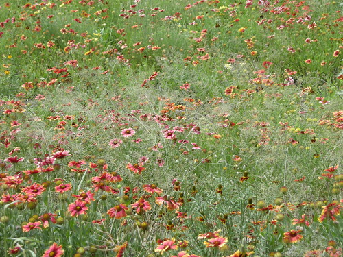
This year's rainy season of 2017, California experienced one of those unprecedented rainy seasons, after four years of serious intense drought. But everyone cheered Hooray 🙌 and celebrated with waving pom poms that all was well again in California again. The drought was now over, or was it. Indeed, heavy rains came, even to the point of major flooding events up and down the state. While there were some very clear catastrophic negatives, one of the great joys of all that rain brought out a spectacular display of wildflower blooms. Starting in early March, flowers popped up all across Southern and Central California and produced some seriously spectacular scenery. The photo opportunity didn't go unnoticed nor wasted by many of the non-profit eco-activist groups hoping to cash in on a fund raising opportunity by posting pics on their website's & Social Network pages indicating that Nature seemed to have rebounded from the jaws of death. Or you know, that old Jurassic Park Cliche (a phrase or opinion that is overused and betrays a lack of original thought) "Life found a way." Except that things really were'nt all that rosey as they advertised. First, some of the people were a little too anxious about getting out there first with they cameras. Then it appears that much of the water came in so fat and furiously, that most of it raced back to the Pacific Ocean like a bullet train. Some water did fill up many of the State's reservoirs, but the surrounding landscape didn't have great percolation into the hills and mountains. 

Roger C. Bales
Even Merced hydrologist, Roger C. Bales, who advocated & pushed for increased logging in the Sierra Nevadas which he claimed would stop water hog trees from gulping down precious water which would have otherwise ended up in streams and rivers causing reservoirs to fill for his agricultural buddies to use downstream (See the Modesto Bee article: Overgrown Sierra forests gulping water that could flow to Valley ), jumped up and down when the rains came. Why ??? Because now his story has changed. He now claims to have been proven right because the 130+ million dead trees caused by the out of control bark beetle outbreak didn't have a chance to suck all that water which ended up in the streams and rivers and filled all the reservoirs. This is a farce folks. The great lack of water over the past five years had zero to do with there being too many trees sucking & gulping all the water down and had everything to do with the State's worst mega-drought in years. It hadn't rained in those five years (or extremely little rain coupled with high Temps) and with or without trees water eventually won't run in creeks, streams and rivers to fill reservoirs. Even a child gets that. I knew this from viewing early on all the photographs of dried dead invasive weeds and not all that long after the flowers died that the drought was not over. Now look where they are over there with heat waves and no more rain. Plus as indicated at the top of this post, lookie where we are now with the 2017 Wildfire season stats. So have things really changed for the better ? Nope, same old same old. 😏


Look, I refuse to celebrate and worship fire as some kind of animist Creator the way most fire ecologists worship it. Yes fire has always existed and is a reality in the natural world and can be used as an excellent tool for correcting problems along with other management tool like thinning forests in any ecosystem if done properly. And I've actually done that. But mostly humans have misused and abused fire, even the so-called experts. Prior to 2006 I never read much of anything about the science discipline of fire ecology, although I worked with people in the US Forest Service back in the 1980s who did prescribed burns. But I've also fought them tooth and nail against many of their ideas which are complete failures when it comes to reforestation techniques. Take the Fire Ecologist insistence that fire is needed for the wild seed germination. For example, Tecate Cypress is one of those trees in which Fire Ecologist have insisted for decades needs fire in order to propagate itself. Prior to reading their literature, in all my 30+ years of outdoors exploration experience and seed collecting, I never found this to be true of Tecate Cypress. There are numerous circumstances under which the seed is dispursed or spread and germinates fine without the need of fire within old growth chaparral which hasn't burned in a couple of hundred years. Same with Arizona Cypress. Fire is not always necessary, but you cannot tell them this. Science is not supposed to be about working in a Lab and venturing outdoors once in a while on a couple token field trips to make the research look legit. You have to live outdoors with nature. Look, I am not credentialed. I have no alphabet soup initials behind my name, nor some fancy coveted title before my name. Thank God. That allows me the freedom of not being shackled to a dogma and infected by the worldview biases and flawed presuppositions common to the Scientific Orthodoxy's industrial business model. I'm just one of 6+ billion people on Earth subjected to the negative consequences of inept decision making from a world leadership which has been weighed in the scales and found deficient. But it's allowed me to view things from a periferal viewpoint as opposed to tunnel-vission. 

Image from H. Armstrong Roberts/ClassicStock

BTW, here is an example of Prairie Fire and a Steam Locomotive, 1872, whose smoke stacks belched cinders (pre-spark aresters) and started numerous prairie and forest fires in the days of the old west. Wonder if that was ever factored into the fire ecologist fire is a creator research ??? This video below from China's still operational locomotives servicing coal mines just question begs, "Do fire ecologists who insist that  fire is a natural necessary healthy component of plant ecosystems ever factor in human stupidity as part of that natural component mechanism ???" I know I know, because the Indians did it! 😕

Fire sparks of Steam in Sandaoling Coal Mine Railway China


References I've written for seed germination, not entertainment, just practical real world application and fun:


Thursday, July 28, 2016

Palo Colorado Canyon now a Paradise Lost ?


Previously I've over the years visited this secret place and only a couple of years ago wrote about it. But Recent Wildfire events in California (this is the latest 'New Abnormal') have brought live to the area to ashes. Here are my previous posts. The first one is about the joy of being able to show my Swedish wife who has never seen the Redwoods of NoCal a little private hideaway slice of giant Redwood Groves. Honestly, other than locals up this way, most tourist and most resident Californians in general no nothing of this hidden gem. That has always been the beauty of this pristine area. That's all changed now. First, ere is what I previously written about Palo Colorado Canyon.
Palo Colorado Canyon Rd, Big Sur California
My other article dealt with the extreme California Drought designation label given specifically to Central California's Coast where extremely low rainfall amounts over the past five years have left most streams and rivers as dry creeks, washes and floodplains. But not here. Why ? Because of the ideal location for fogbelt influence which acquires another type of precipitation normally overlooked. Because of this, streams and rivers still run here. There is also the natural phenomena of "Hydraulic Descent" which almost no one mentions anymore. This is a large part of why these streams still ran to the Pacific Ocean.
Why Streams still flow in California's officially designated "Exceptional Drought" zone
Now, fastforward to the Soberanes Wildfire

Image - David Royal, Monterey County Hreald via A.P.

The above photo is from the Soberanes wildfire burning above a home in Palo Colorado Canyon in Big Sur, Calif., Sunday July 24, 2016. Thousands of homes remained evacuated Sunday as California's two massive wildfires raged in tinder-dry vegetated hills and canyons. As of July 28, about 57 homes have been destroyed and other buildings.

July 24, 2016 - Infrared Imaging Map by www.xasauantoday.com

Keep checking the link above from the reference link I've posted below as the fire is rapidly expanding. I started this post on the 24th and change is happening rapidly.

Night Image by Caitlan Conrad - KSBW


MODIS map of Soberanes Fire - Big Sur Kate - (blue line is Sunday July 25, 2016  Fire Border)

As I've previously posted before back in July 2014 in my Palo Colorado Canyon post, this canyon and beyond is no stranger to wildfire as you can see below of the California Coast Redwood trees with charred bark. The further inland you drive to the east, the hotter the climate becomes. The area is dense wilderness and very few roads. Many of those roads can be death traps as there is very little way out of dead end trails.

Image is Mine from July 2014 (Palo Colorado Canyon Road)

CalFire engine trucks now move into the interior where fire fighting will be tougher, if not imporrible. Air (Plane/Helicopter) and Hand Crews will be the main means of fighting this basically roadless area. That was always the beauty of this area as it is mostly uninhabited. The main thrust of the fire now appears to be heading east and mainly south into the Los Padres National Forest where much of that has now been closed off to any visitors.

Image by KSBW - Caitlan Conrad

Image - David Royal, Monterey Herald

You may have to click on the above image and make it larger. Notice the non-native Sea Fig these fire fighters are strip removing ? Mostly likely on the steep coastal slope side down to the Coast Highway. I'm curious as to how many of these firefighters will acquire poison oak breakouts. For those familiar with this steep coastal environment right down to the Pacific Ocean, the predominant plant here is low growing poison oak. I saw this back in 2014 the last time my wife and I went through here. We stopped periodically to take photos from off the roadway and it's an obstacle and maze of trails through poison oak. Along with poison oak, the other dense invasive I saw were small non-native Pampas Grass everywhere. The stuff is literally everywhere folks. Keep an eye out if in this area. On every single steep treeless slope along the coastal highway there is one solide mass of poison oak from Carmel all the way to Cambria.

Image by Lucus Gillman - Big Sur, California
San Luis Obispo News: "Climate change is making poison oak stronger"

Image - David Royal, Montery Herald

The image above in the northern part of the fire and also these next two Bulldozer photos are on Mescal Ridge are sad to see. The damage these machines cause can last for centuries as scars on the landscape, aside from the immediate microbiological damage where the absence will make it tougher for shrubs and trees to come back. It will better help non-native invasives to establish and grab a permanent foothold. What's worse is that the fire retardant all along those fire perimeter areas are going to help encourage & fertilize the non-native ruderals and hinder perennial and chaparral shrub regrowth. But I'm actually surprised by the one at the top wheere you can clearly see the fire has been stopped by the plane drops of retardant and only small areas of white smake are present. Clearly instead of damaging this ridge and creating a large fire break, I would think Hand Crews could do a less damaging job in putting out the smoldering shrubs and perhaps water drops.

Image provided by Michael Troutman & Big Sur Kate

This link will be of interest to some. This is an operations map showing where bulldozer firebreaks have thus far been constructed and where they are proposed in the future should the fire breach the others. Which it has multiple times.
Soberanes Fire Operations Map

Image provided by Michael Troutman & Big Sur Kate

July 28, 2016 Update: Some Sad News 
Firefighter killed in dozer accident on Soberanes fire & another dozer operator injured in similar scenario
"The operator of a bulldozer was killed while working on the Soberanes fire, one of two major wildfires burning in California and one that has already destroyed 20 homes." 
http://wildfiretoday.com/2016/07/27/firefighter-killed-in-dozer-accident-on-soberanes-fire
 ------------------------------------------------------------------
WRAL.com - Bulldozer operator killed fighting California blaze 
"Another operator escaped injury when a second bulldozer rolled over and sustained minor damage, according to the California Department of Forestry and Fire Protection."   
"Battalion Chief Robert Fish said the operator was working in steep and difficult-to-access terrain when the accident occurred. Fish did not have further details about the incident but said 60 bulldozers were being used in the fight against the fire."
 http://www.wral.com - Bulldozer operator killed fighting California blaze
 =====================================
 Climate Change - Extreme Drought - Beetle Killed Trees - Disease/Pathogens - Fire & Flood Apocalypse ?
 There is a plethora of life degrading events which have effected all of Earth's ecosystems everywhere. Certainly this region which is at the heart of Extreme Drought conditions, actually being designated, "Exceptional Drought Zone" by the US Government just last year. There has been a domino effect of sorts. Extreme drought followed by beetles & pathogen kill of forest trees has made this fire move much easier than it's normal previous marine moisture ecology of the past.  
Millions of dead/dying trees have nothing to do with Climate Change ???

Photo Credits - Dave Rizzo, UC Davis (2005)

Millions upon Millions of dead and dying trees and there is no Climate Change ? Of course some acknowledge there is a climate change happening, but insist it has no human cause. It's not just conifers folks, it's also oaks and other shrubs which are taking the hit here regarding diseases and pathogens.

Photo Credit - Karl Buermeyer, COMTF (2003)

Susan Frankel, USDA-Forest Service
The image above and at right are of dead (Tanoaks - Notholithocarpus densiflorus) along Big Sur highway, Monterey County, California. I know no one wants to talk about dead forest trees causing wildfire to worsen, but hey, this is the "New Abnormal" , remember ??? Like those millions of dead Ponderosa Pines and Fir trees over on the eastern border of California, these trees are helping to spread the wildfire in a region which is traditionally Marine Air influenced by moiture. Sadly, this is a part of that major plague in California called Sudden Oak Death. Also remember that this area has been designated in all the drought maps as Extreme Drought Condition. The worst hit from Climate Change of anywhere throughout all of California. This is about all I'll write on this for the moment. You can follow the other links below and perhaps I'll provide periodic updates here from time to time.
Update August 1, 2016
 (David Royal - Monterey Herald)

This photo shows Cal Fire firefighters keeping a lookout from Sky Ranch off Cachagua Grade as smoke and flames from a back burn light up a ridge to the south as firefighters battle the Soberanes Fire in east Carmel Valley on Monday August 1, 2016. Even though the photo is hazy, can anybody see the numerous dry dead oak trees within this forest canopy ? All vegetation, living green or dead brown will burn. But it's the dead material which allows the wildfire to move faster and gain more ground. And that's exactly what this fire has done.
Some Sudden Oak Death References 
http://www.suddenoakdeath.org/library/photos/landscape-photos
http://www.suddenoakdeath.org - A SELF-GUIDED TOUR OF SUDDEN OAK DEATH (Phytophthora ramorum) ALONG THE BIG SUR COAST MONTEREY COUNTY, CA
Soberanes Wildfire Tracking Website Links
http://inciweb.nwcg.gov 
https://xasauantoday.com/2016/07/22/soberanes-fire
KSBW: Soberanes Fire prompts evacuation order for Rancho San Carlos
https://bigsurkate.wordpress.com
Central California Coastal Ecology and Wildfire History
Mid-Coast Fire Brigade: 'Area Fire History'
Garrapata Creek Watershed Council & Watershed Assessment

Saturday, August 10, 2013

Common Sense Reasons for Modern Wildfire Intensity

Non-Native Grasses and the human connection for their rapid spread


 photo by Guy McCarthy.
This photo taken around 2:55 p.m. shows smoke rising from
 south of Banning on Aug. 7, 2013. Banning-Beaumont Patch
The scene to the right is Hwy 243 leaving south from downtown Banning up into the San Jacinto Mountains towards Idyllwild California. For almost two decades, I traveled past this very location going to and from work a few times a week. Notice the foothills leading up into the mountains ? They are mostly non-native grasses and other invasive weeds. Not the native wildflowers of the old days when fires went through on a not so regular basis. This week, the Media's favourite so-called Fire expert, Richard Minnich did mention the 1974 Soboba Fire [which gave birth to the Penny Pines Plantation next to Bay Tree Spring - BTW, pines planted were not natives (yet another great Science blunder)] and the (2006 Esperanza fire) which was infamous for taking the lives of five firefighters and burning well over 42,000 acres. He neglected however to mention the 1968 Poppet Flats Fire and the countless other fires which have practically turned this part of the mountain into a mosaic of chaparral and non-native invasive weeds which burn like gasoline (even Minnich admits this). 


image: Mark Alburger

(click on this link to enlarge)
Take a look at the photo above. Some of the first eye witness observer comments were that when the fire first started, it was only 200 acres, but in 30 minutes time it grew to be 2,500. How did that happen ? Grasses! I've watch this mountain range's transformation for almost 25 years now. The lower foothills and steppes are becoming more and more devoid of low sage scrub and the deeper high elevation chaparral is yielding as well. Take the photo above and left here, this same location going across the wash and up the Palms to Pines Hwy 243. Look at the almost pure invasive grass ecosystem which has replaced the majority of the Chaparral. This location has burned almost every years or at length, every couple of years. Not the type of excitement News making fires, but enough to make major impacts on the local ecosystem's demise. In fact, I doubt many remember that on the northern end of Banning of this year 2013, they had a rather large fire back in May called, the "Summit fire". There were some homes lost then as well.
Photo: Stan Lim

CHP Officer Adrian Horta stand at a check point on Hwy 243
looking towards the same exact point of the top photo.
The area is actually one of the worst fires areas for no other reason than that permanently blowing wind through this Pass from the south and west. I seem to remember when every summer in the 1980s to 90s while being in the Hemet/San Jacinto Valley and looking at some dirty gray-brown mushroom cloud to the north and it was always close to this location. From Vista Grande Ranger Station west to Moreno Valley along Hwy 60, these hills have traditionally burned year after year for decades. Grasslands are the predominant ecosystem now which has replaced the low growing chaparral scrub like Buckwheat, California Sagebrush etc. Notice in the third photo here how rapidly that fire has not only grown in size, but even moved west against the westward driven wind flow patterns. The fire speed difference in terms of burn time & distance of a Chaparral landscape versus grass landscape are dramatic. The situation  been made further dangerous by horrible mismanagement created by misguided [though perhaps well intended] Fire Management Policies based & structured solely on the bad science of a select few Forestry-Cult Media figures who are looked upon to as Fire Ecology Gurus. Frankly, their time and outdated thinking should be over. Unfortunately, for many areas, there is no turning back the eco-clock. The results of failed policies based on their bad science reveal that their expertise has destroyed more than they've helped in off fire season management. Scary scenario now is that globally with Climate Shifting, many fire seasons are running close to a full year any more. Something has to change, or the Natural World up in the San Jacinto Mountains and elsewhere will be ruined forever. I use to think Nature could take and handle all manner of abuse, but clearly I was wrong. 

Take the example below of a wildfire management program which is a major failure, although the people behind this Hwy 74 firebreak creation program would probably never admit this. This project I have to imagine was a strategy of creating some imaginary barrier along both sides of Hwy 74 west of Mountain Center and Idyllwild in hopes of preventing a major megafire advance towards those mountain communities. These images expose the incompetent  horrible planning and decision making which demanded the  removal of old growth Chaparral on both sides of the Highway, the result of which has allowed invasive non-native grasses to infiltrate. This terrible decision was started and in progress in 2010 and through 2011 when I last visited this area with my wife. At that time I should have taken photos as it was in progress, but I didn't. However I knew exactly what would happen. There were large massive piles of brush which were later hauled off site to an area for grinding up the chaparral. Now fast forward here to 2013, some chaparral vegetation has grown back, but in a far worse case fire scenario circumstance than previously before chaparral removal. You should know that several psychopath Arsonists have actually tried to start fires here at this east end of the canyon and only created smoldering white smoke previously and were caught as a result of the difficulty of actually getting a raging fire going. The new invasive grass habitat almost guarantees such attempt will succeed in the future.


Photo: Mine
This is the south facing view on a Turnout near the Cold Creek Creek Canyon [which comes out of Mountain Center] at the bottom before highway Route 74 takes a sharp U-Turn and switch backs westward up the mountainside. This was not a Control Burn Project, but rather a chain saw job performed by Hand Crews to remove chaparral to the ground. Then the brush piles were hauled off to disposal sites. The chaparral dander or leaf litter was also removed to bare soil. Stumps were being sprayed with something to further kill them. While the idea may have been well intended  and certainly a form of 'eye-candy' which appeases the Public who demand something be done, the conditions now have been made worse than the previous condition as the photo below reveals.


photo: Mine
These are the dry Foxtail Grasses and European Wild Oats that were never here prior to the cutting of Chaparral. I found them to be all alone the shoulder up through Mountain Center and in the case of the wild oats, I had never before seen up so high. These latest drought conditions are also not allowing the Chaparral to recover quickly. During wetter seasons in decades past, the ecosystem would have repaired itself much more quickly and efficiently. But we are now in an era of changing dry times when it comes to weather issues. The biggest danger here now is that some idiot throws his/her cigarette out the window and ignites another megafire. With the former Chaparral cover scenario, that was never an issue. Even if a fire from a distance comes up the canyon as feared, they have almost guaranteed it's further rapid progress by this horrible decision to defoliate this area of much more stable system and replacing it with a virtual powder keg.

(image from San Jacinto Ranger District off Hwy Route 243)


Here is another photo I took on the way up and in fact there are several. Most of the surrounding San Jacinto Mountain foothills from this S.J. River Canyon to Lambs Canyon (State Route 79) and beyond to Hwy 60 are almost totally solid grasses. What this means is that any future fire under similar conditions will take off far more efficiently speed-wise from a disaster scenario point of view and be so large by the time fire fighters attempt some sort of battle plan organization, that getting an initial upper hand on the situation will be near to impossible. These grasses burn like gasoline, while chaparral, which it can be explosive & spectacular to watch during intense wind extreme moments, quite often burns at a much slower pace which allows for much more efficient timeline fire fighting strategies to be implemented. These next two images are of the southern face of Indian Mountain, though most people won't recognize it, though perhaps only from the northern viewpoint turnout on Hwy 243.


photo image: Mine

This is a view of the southern face of Indian Mountain, though many never think of that landmark from this point of view. A number of Truck Trails like Indian Creek, North Fork of S.J. River and Bee Canyon Truck Trail are present on this side of the mountain. This side of the mountain has burned numerous times in the past and as you can see it being presently dominated by non-native European exotic grasses. When the Bee Canyon Fire blew over this area, there was still some low growing Chaparral scrub, and it made fast progress. However, it is almost entirely grasses, and an even faster fire growth scenario will most surely take place next time and there WILL be a NEXT TIME. When I originally moved to the San Jacinto Mountains back in 1981, this same mountain was dominated by an interior version of coastal sage scrub plant community. A photo then would be showing a darker green plant presence across the same non-native grassland at present. 


photo: Mine

(click to enlarge view)
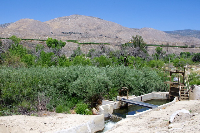
This view of the irrigation aqueduct which funnels water from Lake Hemet via the South Fork of the San Jacinto River is directly across from Cranston Ranger Station. Same pic as above but from different perspective. Below is a link further up the road at the S.J. North Fork crossing. Click to enlarge and zoom up that mountain in the background and take in the unnatural grasslandscape.


photo Mine(click here to enlarge the view)
I took this photo this past May 2013. It is a view of the grass infested southern foothill terrain of the northern part of the San Jacinto Valley. These hills have been burned off countless multiple times and are a rapid fire tinder box just waiting to explode again. Movement of fire of course would be in the same direction as the present Silver Fire. Soboba Indian Reservation was always notorious for starting many of these devastating fires. There was hardly a summer which went by in the 80s and 90s where smoke couldn't be seen in the mountain terrain above that Casino.
The main issue here is that the Chaparral Plant Community is almost always unfairly and UNSCIENTIFICALLY blamed for the destruction of human infrastructure over the past few decades. But as you can clearly see, there have been many homes which burned with intact trees, chaparral and exotic landscape often left untouched by flames and homes burned to the ground. Why ? Some homes in this latest Silver Fire have been burned to the ground with large bare ground defensive clearances and yet they burned down to the ground, Why ? Most of it has to your with regular maintenance. Your home and garden/Landscape need proper regular personal hygiene just like your own body. Neglect this and problems develop. Most rain gutter and roof tiles need cleaning or when embers rain down like a downpour of a Thunderstorm, these things get blown into the cracks and crevices where they smolder and eventually ignite. The flame is at first very tiny and almost un-noticeable. But gradually it can be doing some internal burning within the structure's walls.  
One morning early in 1993, I remember waking up early and listening to the News Reports going crazy about numerous major wildfires going on in Southern California all at once. It was October and the Santa Ana winds were in full force. The Laguna Hills and Beach fires seemed to have gotten most of the attention, but there were others closer to hone which were of more concern to me. The October 1993 Winchester Fire which burned 25,000 acres in almost a day, was a burn which mostly blitzed at lightning speed  through nothing more than a grassland plant community. Grass is like Petrol when it burns. There were 29 homes lost on those grassland flats where the fire burned from south end of State Street Hemet near the present Diamond Valley Reservoir Headquarters  [which had not yet existed] all the way to Lake Skinner and French Valley near Temecula. So 29 Homes in grassland were destroyed and if there was any chaparral at all in these valleys and rolling hills, it was low growing coastal sage scrub plant community being overwhelmed by grasses. To be honest, much of this area was also the former Kaiser Cattle Ranch from which most of Temecula is now built on top of. Cattle Ranchers want grasses, not what they term as invasive brush [vulgar term for chaparral] which impedes their business model. Mostly this Winchester Fire in 1993 was one massive grassland. Most of the non-native grasses, brought here by error-prone humans ignorant of their effects on the native local landscape were the real culprit, not chaparral. And yet the grasses cannot be totally blamed either, as human ignorance in land management over many decades has facilitated their wider spread. There is something else I also remember about this day. During this same Winchester Burn in 1993, something else was also happening right up in Anza in and around the Cahuilla Creek Casino and Lake Riverside Estates. After being glued to the Television News Updates, I decided to take a walk outside and see if I could see any of the smoke from the Winchester fire that was given occasional mention. The Santa Ana Wind conditions were blowing fierce at my hilltop home and there was another fire for which the News had yet to mention. A Fire started up in Anza with it's flash point of origin as an Electrical Pole near the Cahuilla Indian Reservation Cemetery. Incredibly, at the beginning, this fire burned through a wide swath of the green Sedge  meadow landscape at lightning speed burning all the way to Lake Riverside and Cowboy Country Trailer Park on Bradford Road. This was reminiscent of what was said about a green grassy meadow in the Mount Jacinto high country just a few weeks ago which they said went up in a flash. Under normal healthy conditions, Sedges generally are not a flash point, but conditions in our times have changed. These non-native exotic grasses taking over once native chaparral landscapes will continue to spark the megafires making far worse and more uncontrollable than ever before. Climate Shift will only exacerbate the problem, but will anyone really be paying any attention by NOT blaming Chaparral ? Will they now stop listening to many of those supposedly qualified Fire Ecology experts who know nothing of how the chaparral plant community actually functions and put a halt to their failed Control Burn operations in remote wilderness areas far away from any urban areas which has thrown nature off balance ? Not only that, it wastes resources and eats up money which could otherwise be used for actually fighting the fires which are going to happen whether they do anything or not. Of course, the average citizen should not depend on the authorities to actually save anything, but there are some thing that you can do as far as home construction details. While different circumstances, solutions and money will dictate what you are able to do, there are still some interesting details mentioned in the link under the photo below.
(AP Photo/Douglas C. Pizac) 

 Fire-Resistant Details

"The October 1993 Laguna Hills Fire  destroyed more than 350 homes  in a single day (more here). In this image: a single home sits virtually  untouched in Laguna Beach, California, on October 28, 1993, after wildfires reduced neighboring homes, and hundreds of others,  to rubble. When the Bui/Bender residence (pictured above) survived  the devastating 1993 fire in the Southern California Coastal town  of Laguna Beach, people called it a miracle. The fact that the only damage to the structure was a drainage downspout dislodged by a fire hose may have had more to do with the fact that it was designed and constructed in accordance with the principles outlined  in this very interesting article from Fine Home Building."
~~~~~~~~~~~~~~~~~~~~~~~~~~~~~~~~
Some relevant links on the October 26/27 1993 Winchester Fire & 17 others: 
Endangered Species Act and Fire Controversy that followed the 1993 Winchester Fire
The Wildfires of Southern California in 1993
What more is there to say, but people need to pay attention to the way fire dynamics are changing for the worse and plan accordingly. The bad land management examples being practiced by irresponsible agencies should be improved upon by the average land owner IF they actually care about their own property. Previously I touched on this here:
Forestry's Land Mismanagement has an Influencing Effect on it's Citizens
~~~~~~~~~~~~~~~~~~~~~~~~~~~~~~~~
Further Research References: 
The California Chaparral Institute
"The Banning Silver Fire Photos - Illustrations that Teach"
Wildfire Potential for Southern California August thru November 2013

Thursday, June 20, 2013

Alligator Juniper (Juniperus deppeana) @ Ramsey Canyon Arizona

Photo: Mine
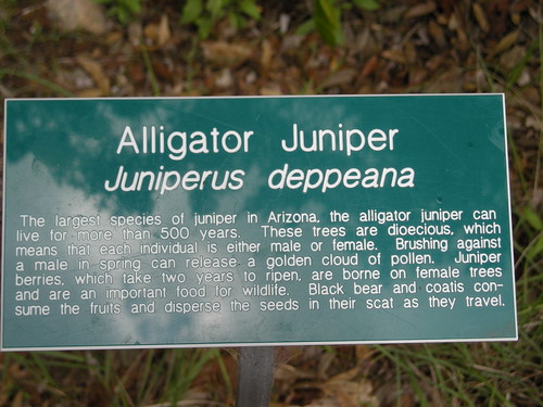
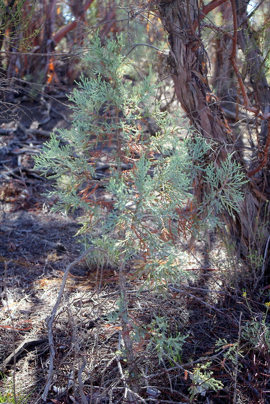
On some previous trips to Arizona I always seemed to find something I wanted to take back as a specimen souvenir. Just to see  how it would fare in an Anza high Mountain ecosystem. Many similar climates around Arizona when comparing Anza Valley. This particular trip where the plant was collected was up above Ramsey Canyon in the Huachuca Mountains above Sierra Vista Arizona. The large tree specimens and signage above were down in the Canyon walk itself. The little tree I found was from driving up Carr Canyon Road just south of Ramsey Canyon Rd which takes you up to higher elevations. As I revisited Anza this year I could see that people are still making the same old blunders purchasing plants from conventional Retail Plant Nurseries only to see their landscape choices fail. But I brought back a tiny 5 or 6 inch high Alligator Juniper seedling from that trip. The time was summer in August. I know, odd time for taking a specimen where most would have collected it in winter or early Spring. But it is possible to collect and transplant if you know what to do and do it quickly. I've done Sycamores and Big Leaf Maples this time of year and with great success as well. 


Credit: Forestryimages.org

Thumb sized PT Mycorhizae Truffle associated with
young Slash Pines
Back in the 1990s, I was still using Plant Health Care Inc's (PHC) mycorrhizal inoculation mixes. This particular mix I used was called Tree Saver Injectable. I never used a high pressure injection system, I simply used to apply the powder which contained natural humic acids for triggering root growth and most importantly Pisolithus tinctorius spores. I also added some wild collected spores from truffles collected off the Dunn Ranch just north of Hamilton Creek Canyon in eastern Anza. The initial response after a month of transplanting the 6 inch high Alligator Juniper was that a thumb sized Truffle appeared at the base of the tree. Truffles will not appear unless they are able to draw off the carbons of their host. The picture above from Forestry Images for which I am a member, is almost as exact as what I have experienced with all pine and oak transplants or new tree inoculation. Only after the next rainy season and Spring growth will you ever notice any improved vigorous grow in both stems and foliage. The odd thing here with the Juniper however, PT Mycorrhizae is host specific and supposedly will NOT colonize with Junipers. Surprise surprise!

Photo Mine


This little tree was planted in 1996. It never struggled, but did get nibbled on by rabbits until I put the chicken wire around it. Babied it the first your with regular weekly water and tapered off with monthly. After that first year I did nothing. As you can see, it is now about one meter high as of June 2013. Also, notice I put it smack in the middle of old growth Redshank or Ribbonwood (Adenostoma sparsifolium) Chaparral High Desert Elfin Forest. I
never do give it another thought to remove what many people usually consider evil competition. I also contacted Dr Donald Marx (PHC Chief Scientist) in Frogmore South Carolina when I discovered that the colonization actually took. He was blown away too. So was I. So I sent him some pics. It's amazing how much there is yet to be discovered, especially in such an arrogant world where the leadership believes it knows it all. Eventually when the root system reaches a maximum point of establishment and the top of the Juniper pushes through the Chaparral tree canopy, it'll really take off. In the mean time, the environmental conditions will allow very few lower tree branches and being supported in early life by the chaparral will have a nice clean trunk for which that characteristic Alligator bark will manifest itself beautifully.


Photo: Mine
Photo: Mine
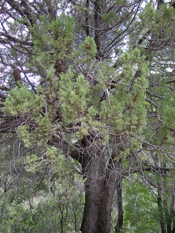
With Alligator Juniper, it's that characteristic reptilian bark pattern that catches and captures your attention while out on a hike. Some giant twisting individuals look like some prehistorical beast trying to free itself from the Earth's hold on it. Arizona Highways one year had a picture of a long dead Alligator Juniper, but which it's skeletal size still provided an illustrative vision of what it must have looked like when still alive.

Photo: Mine

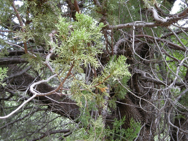
Some interesting fire ecology facts about Alligator Juniper. While like most other living plants this tree will burn, but it also has the amazing ability to sprout back from it's root system. It's rugged reptilian looking bark is tough enough to withstand fire and has been noted that most canopies and crowns of Alligator Juniper are untouched, although lower limbs may be scorched. The foliage example as referenced in the picture above reveals just how beautiful this tree could be for the landscape and especially in areas where there are water issues.

There were other trees and plants worthy of note in the Huachucas. Apache Pine (Pinus engelmannii) is another one of those interesting pines that doesn't fit the profile of pines in So-Cal. It has a brighter green foliage which is itself much like those long subtropical needles pines. When it is a young sapling, it is often referred to as the "Hippie Pine". I acquired one years before my Alligator Juniper find, from a Native Plant Nursery in Elgin Arizona just south of Sonoita. The Nursery was owned by James (Jim) Koweek of Elgin and he later moved his Diamond JK Nursery to Sonoita Arizona just to the north at the Junctions of Hwy 82 & Hwy 83. He has since sold it and now has a Soil Preparation Services company and website here: http://www.azreveg.com/


Photo: Mine

This particular Apache Pine was up that same Carr Canyon Rd. I planted one of these Apache Pines on my Anza property in the early 1990s. After I sold that property in 2002, in 2003 it was rented out by the new owner to a guy who was a tree trimmer. He had lots of equipment and wanted a place for parking it. Understandable since Anza is known for having plenty of citizens with sticky finger tendencies. But he leveled half a dozen fairly large pines to do this along with Chaparral and the Apache and Arizona White Pines were among these. When I visited a few years later and discovered the loss, it was similar to my shock with the Rattlesnake Mountain Torrey Pine removal. Oh well, it was no longer my place anyway. But that Apache pine was almost 10 foot tall with good branch density when I left. The foliage of course stood out with it's bright green (almost Ponderosa looking) and did also prove that such pines would do well there. For all you off the hill plant shoppers, get a clue.


Photo: Mine

Just by way of location and height reference for the former Apache Pine on my property as of 2002. This photo above is a fortunate Coulter Pine that was not touched by the tree trimmers Ax or Chainsaw. You can see the height and branch circumference here are very very healthy. The Apache Pine was on the other side of this photo angle to the north and this tree was only one and a half foot tall compared to the 10 foot tall Apache when I left. So the Apache would have been more than doubled in it's size today if still alive. Also keep in mind as far as growth and health issues go, none of these trees on my former property are watered and have even endured the low rainfall years (eleven or twelve) since 2001 until this present day. So they still haven't done too bad. Shows what a healthy mycorrhizal grid network will do for a landscape system.
And Finally - 


Photo: Mine
Photo: Mine
Photo: Mine

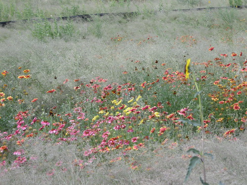
These last three pictures are of the meadows of grasses and flowers leaving Ramsey Canyon back toward Hwy 91 South. Keep in mind the best time of year to visit is July/August when the summer Monsoons are in full force. Sad to say, from the climate shifting News Reports I am hearing, there may be an abnormal shift from July/August to September/October. This may well screw up many things with regards several ecosystems in the southwest.

~~~~~~~~~~~~~~~~~~~~~~~~~~~~~~~
Good Reading References:

U.S. Forest Service & Alligator Jumiper Fire Ecology