Non-Native Grasses and the human connection for their rapid spread
 |
| photo by Guy McCarthy. This photo taken around 2:55 p.m. shows smoke rising from south of Banning on Aug. 7, 2013. Banning-Beaumont Patch |
 |
| image: Mark Alburger (click on this link to enlarge) |
 |
| Photo: Stan Lim CHP Officer Adrian Horta stand at a check point on Hwy 243 looking towards the same exact point of the top photo. |
Take the example below of a wildfire management program which is a major failure, although the people behind this Hwy 74 firebreak creation program would probably never admit this. This project I have to imagine was a strategy of creating some imaginary barrier along both sides of Hwy 74 west of Mountain Center and Idyllwild in hopes of preventing a major megafire advance towards those mountain communities. These images expose the incompetent horrible planning and decision making which demanded the removal of old growth Chaparral on both sides of the Highway, the result of which has allowed invasive non-native grasses to infiltrate. This terrible decision was started and in progress in 2010 and through 2011 when I last visited this area with my wife. At that time I should have taken photos as it was in progress, but I didn't. However I knew exactly what would happen. There were large massive piles of brush which were later hauled off site to an area for grinding up the chaparral. Now fast forward here to 2013, some chaparral vegetation has grown back, but in a far worse case fire scenario circumstance than previously before chaparral removal. You should know that several psychopath Arsonists have actually tried to start fires here at this east end of the canyon and only created smoldering white smoke previously and were caught as a result of the difficulty of actually getting a raging fire going. The new invasive grass habitat almost guarantees such attempt will succeed in the future.
 |
| Photo: Mine |
This is the south facing view on a Turnout near the Cold Creek Creek Canyon [which comes out of Mountain Center] at the bottom before highway Route 74 takes a sharp U-Turn and switch backs westward up the mountainside. This was not a Control Burn Project, but rather a chain saw job performed by Hand Crews to remove chaparral to the ground. Then the brush piles were hauled off to disposal sites. The chaparral dander or leaf litter was also removed to bare soil. Stumps were being sprayed with something to further kill them. While the idea may have been well intended and certainly a form of 'eye-candy' which appeases the Public who demand something be done, the conditions now have been made worse than the previous condition as the photo below reveals.
 |
| photo: Mine |
 |
| (image from San Jacinto Ranger District off Hwy Route 243) |
 |
| photo image: Mine |
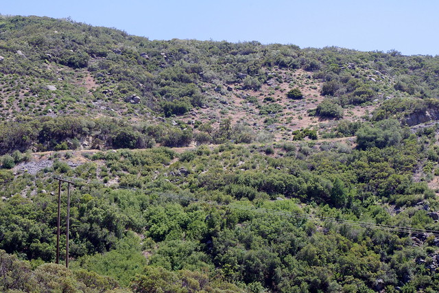
This is a view of the southern face of Indian Mountain, though many never think of that landmark from this point of view. A number of Truck Trails like Indian Creek, North Fork of S.J. River and Bee Canyon Truck Trail are present on this side of the mountain. This side of the mountain has burned numerous times in the past and as you can see it being presently dominated by non-native European exotic grasses. When the Bee Canyon Fire blew over this area, there was still some low growing Chaparral scrub, and it made fast progress. However, it is almost entirely grasses, and an even faster fire growth scenario will most surely take place next time and there WILL be a NEXT TIME. When I originally moved to the San Jacinto Mountains back in 1981, this same mountain was dominated by an interior version of coastal sage scrub plant community. A photo then would be showing a darker green plant presence across the same non-native grassland at present.
 |
| photo: Mine (click to enlarge view) |
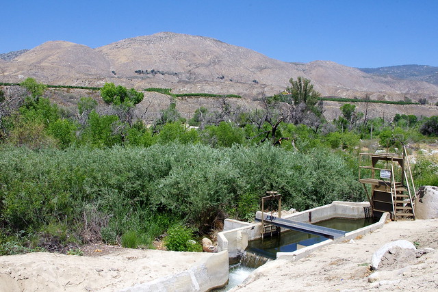
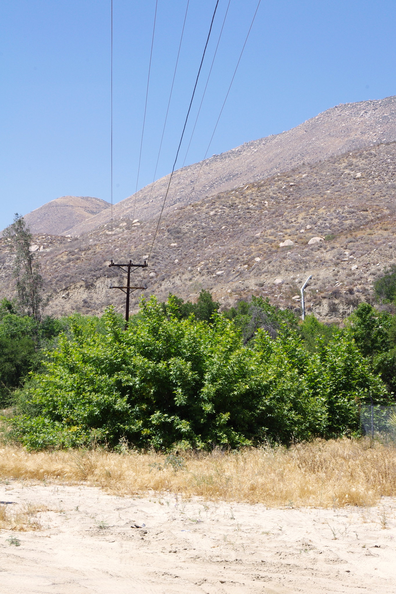
This view of the irrigation aqueduct which funnels water from Lake Hemet via the South Fork of the San Jacinto River is directly across from Cranston Ranger Station. Same pic as above but from different perspective. Below is a link further up the road at the S.J. North Fork crossing. Click to enlarge and zoom up that mountain in the background and take in the unnatural grasslandscape.
 |
| photo Mine(click here to enlarge the view) |
The main issue here is that the Chaparral Plant Community is almost always unfairly and UNSCIENTIFICALLY blamed for the destruction of human infrastructure over the past few decades. But as you can clearly see, there have been many homes which burned with intact trees, chaparral and exotic landscape often left untouched by flames and homes burned to the ground. Why ? Some homes in this latest Silver Fire have been burned to the ground with large bare ground defensive clearances and yet they burned down to the ground, Why ? Most of it has to your with regular maintenance. Your home and garden/Landscape need proper regular personal hygiene just like your own body. Neglect this and problems develop. Most rain gutter and roof tiles need cleaning or when embers rain down like a downpour of a Thunderstorm, these things get blown into the cracks and crevices where they smolder and eventually ignite. The flame is at first very tiny and almost un-noticeable. But gradually it can be doing some internal burning within the structure's walls.
One morning early in 1993, I remember waking up early and listening to the News Reports going crazy about numerous major wildfires going on in Southern California all at once. It was October and the Santa Ana winds were in full force. The Laguna Hills and Beach fires seemed to have gotten most of the attention, but there were others closer to hone which were of more concern to me. The October 1993 Winchester Fire which burned 25,000 acres in almost a day, was a burn which mostly blitzed at lightning speed through nothing more than a grassland plant community. Grass is like Petrol when it burns. There were 29 homes lost on those grassland flats where the fire burned from south end of State Street Hemet near the present Diamond Valley Reservoir Headquarters [which had not yet existed] all the way to Lake Skinner and French Valley near Temecula. So 29 Homes in grassland were destroyed and if there was any chaparral at all in these valleys and rolling hills, it was low growing coastal sage scrub plant community being overwhelmed by grasses. To be honest, much of this area was also the former Kaiser Cattle Ranch from which most of Temecula is now built on top of. Cattle Ranchers want grasses, not what they term as invasive brush [vulgar term for chaparral] which impedes their business model. Mostly this Winchester Fire in 1993 was one massive grassland. Most of the non-native grasses, brought here by error-prone humans ignorant of their effects on the native local landscape were the real culprit, not chaparral. And yet the grasses cannot be totally blamed either, as human ignorance in land management over many decades has facilitated their wider spread. There is something else I also remember about this day. During this same Winchester Burn in 1993, something else was also happening right up in Anza in and around the Cahuilla Creek Casino and Lake Riverside Estates. After being glued to the Television News Updates, I decided to take a walk outside and see if I could see any of the smoke from the Winchester fire that was given occasional mention. The Santa Ana Wind conditions were blowing fierce at my hilltop home and there was another fire for which the News had yet to mention. A Fire started up in Anza with it's flash point of origin as an Electrical Pole near the Cahuilla Indian Reservation Cemetery. Incredibly, at the beginning, this fire burned through a wide swath of the green Sedge meadow landscape at lightning speed burning all the way to Lake Riverside and Cowboy Country Trailer Park on Bradford Road. This was reminiscent of what was said about a green grassy meadow in the Mount Jacinto high country just a few weeks ago which they said went up in a flash. Under normal healthy conditions, Sedges generally are not a flash point, but conditions in our times have changed. These non-native exotic grasses taking over once native chaparral landscapes will continue to spark the megafires making far worse and more uncontrollable than ever before. Climate Shift will only exacerbate the problem, but will anyone really be paying any attention by NOT blaming Chaparral ? Will they now stop listening to many of those supposedly qualified Fire Ecology experts who know nothing of how the chaparral plant community actually functions and put a halt to their failed Control Burn operations in remote wilderness areas far away from any urban areas which has thrown nature off balance ? Not only that, it wastes resources and eats up money which could otherwise be used for actually fighting the fires which are going to happen whether they do anything or not. Of course, the average citizen should not depend on the authorities to actually save anything, but there are some thing that you can do as far as home construction details. While different circumstances, solutions and money will dictate what you are able to do, there are still some interesting details mentioned in the link under the photo below.
 |
| (AP Photo/Douglas C. Pizac) Fire-Resistant Details |
"The October 1993 Laguna Hills Fire destroyed more than 350 homes in a single day (more here). In this image: a single home sits virtually untouched in Laguna Beach, California, on October 28, 1993, after wildfires reduced neighboring homes, and hundreds of others, to rubble. When the Bui/Bender residence (pictured above) survived the devastating 1993 fire in the Southern California Coastal town of Laguna Beach, people called it a miracle. The fact that the only damage to the structure was a drainage downspout dislodged by a fire hose may have had more to do with the fact that it was designed and constructed in accordance with the principles outlined in this very interesting article from Fine Home Building."
~~~~~~~~~~~~~~~~~~~~~~~~~~~~~~~~
Some relevant links on the October 26/27 1993 Winchester Fire & 17 others:
Endangered Species Act and Fire Controversy that followed the 1993 Winchester Fire
The Wildfires of Southern California in 1993
What more is there to say, but people need to pay attention to the way fire dynamics are changing for the worse and plan accordingly. The bad land management examples being practiced by irresponsible agencies should be improved upon by the average land owner IF they actually care about their own property. Previously I touched on this here:
Forestry's Land Mismanagement has an Influencing Effect on it's Citizens
~~~~~~~~~~~~~~~~~~~~~~~~~~~~~~~~
Further Research References:
The California Chaparral Institute
"The Banning Silver Fire Photos - Illustrations that Teach"
Wildfire Potential for Southern California August thru November 2013