Showing posts with label Santa Rosa Mountains. Show all posts

Wednesday, December 26, 2012

Santa Rosa Mountains Part II: "Switch Back Logging Road"

map credit: JustRuns.com 4 WD Club


Sugarloaf Cafe and Market
Okay, this map is an area of Pinyon Flats where the Sawmill  trail head starts at the foot of Santa Rosa Mountain and ascends to almost the top where the abandoned Sawmill camp was originally. From California State Highway 74 and even the Sugarloaf Cafe & market, you can actually see this back and forth meandering switchback road making it's gradual climb to the camp. The Sawmill trail is also called Pigeon Springs Road, which may well be named after a spring which feeds to small lake or pond up at the old camp. I have once driven all the way up there in my Toyota 4X4 in 1986. Of course it really wasn't a public trail back then as you will see where there is now a parking area around which is just before and next to the Refuse Transfer Station. There U.S. Forest Service had not even remotely started construction of the present Cactus Spring - Sawmill Trailhead parking area and adventure jumping off point yet. So I had to drive around a shrubby barrier and up a bank to get to the actual forest road. There always was and no doubt still is a closed iron gate down near the Hwy 74.

Image - Visit Greater Palm Springs
The entrance now though is just prior to the Transfer Station. I went there once after they created the parking area and it's a very nicely maintained starting point. There is an interesting story behind the construction of this long winding switched back road. Back in 1983 I had the privilege of meeting the man who constructed it and found out the reason for it's construction. He lived on Sage Rd in Radec (well, technically Aguanga). His house is out front there of the old famous Cottonwood School House which itself is next to the more modern Cottonwood Elementary School. The house he lived in was an older home with all manner of Barns and other smaller out buildings along with a whole lot of heavy construction equipment. He said the equipment mostly belonged to his son Daniel. The man's name was Jay Dee McGaugh and his wife was Vivian McGaugh. Some of the Idyllwild and Mountain Center residents may know of his brother or even the road named after their family name just west of the Mountain Center 243/74 Jct which is actually called McGaugh Road. That road leads to a Baldy Mountain Meadows area where there is a small Trailer Park and even a medium size lake (when there are wet years) called McGaugh Lake.

Image - Radec Cemetry
Anyway, Dee, as he preferred to be called, mostly did cattle ranching in the old days to make a living. He told us of the story of how he met his wife Vivian and informed her that if she wanted them to move to the city, they'd have a rough time of it, as he only knew ranching. He was a funny old guy with that typical southwestern drawl and all the quirky old time country humor expressions to go along with that New Mexico or Texas accent. You know how country folk have expressions which relate to living life on the land and farm ? After explaining how he met Vivian, and his decision to court her, he explained after he took a liking to her, he said, "So I took to snortin her flank . . " (anyone raised on a farm knows what that is) She, Vivian, interrupted and said, "Oohhh Hooooney, these kids don't want to here talk like that." Anyway, he did a lot of other things to make a living out there, like quite a bit of road building for one. I believe he said he also built the original highway leading east out of Anza towards Palm Desert which most know as Burnt Valley Road. Same road I use to live on. The present highway 371 originally did not run through the Hamilton Creek Canyon. That was later built. Burnt Valley Road which was part of the old Cahuilla Road was the original. The other road he was involved in creating was that famous Sawmill Road that switch backs up towards the top of Santa Rosa Mountain behind Sugarloaf Cafe

Image - TemeculaTim 2008
I'm not exactly sure when this road was built, but I would guess sometime in the 1930s. Dee McGaugh was in the Army during WW II, so at the latest after the war, but I thought he said sometime in the 30s. He said the reason was some experts said the trees had to be harvested because they were labeled as "Bug Trees", which I took to mean they had some pine beetle problem. Anyway, he simply built the road, but never underestimate the justification needed to profit off natural resources by special interests who know somebody in government. Early Sawmills in the San Jacinto Mountains never truly practiced any type of reforestation or replanting programs in the early days. Like most get-rich-quick pioneering ventures, the natural world's raw resources were there for the taking by those who a had the means and the drive to do so. The early irresponsible decision making and consequences of the actions by the early pioneers no doubt have contributed to the present climate change were truly began back around World War I. Although I highly doubt most scientists today would go back that far in making a connection. Countless mammoth trees in Garner Valley, Thomas Mountain and Idyllwild were taken for the building or even rebuilding of southern California cities and industry. The choice of harvesting location was no doubt influenced by the ease of access to the coast. Lumber didn't have to be shipped in from the Pacific Northwest as it does today. In their ignorance of ecology and the environmental disaster they were creating, how could they have possibly known that southwestern forests are incapable of repairing themselves as quickly as those in the wetter northern climates ?

Dee McGaugh said that the forest tree line came down much lower down the switch back then it does now. Makes sense because when I went up there the first time you could see old chain sawed stumps and even stunted Jeffrey Pine trees (sadly a few decades old) in bare spots trying to make a come back and grab a foothold, but with some great difficulty. Considering the huge charred Jeffrey Pine stumps I found on both sides of Hwy 74 near Spring Crest, I had no reason to doubt what he said. Of course experts will disagree as to how low the tree line actually was, but it is clear in only a few hundred years back things were clearly much different then. Even my Great Uncle who was born in 1903 and hunted Thomas Mountain in the 1920s couldn't believe the lack of forest there now when we drove him to Idyllwild in early 1990. He's long since dead now and like Jay Dee McGaugh, you loose a lot of historical knowledge of what the past was really like when these folks pass on. Too bad that we don't think to ask more questions and really get to know them while they are still alive and with us. Below are a few other interesting pics at the old logging kamp like the small lake or pond that is spring fed. Also the water tanks which siphon water off the spring for use in Pinyon far below.

Outdoor Adventures USA

Sawmill Trail on Pigeon Springs Rd


Outdoor Adventure USA

Sawmill Pond created by Logging Company


Outdoor Adventure USA

Black plastic pipe tapped into Spring
Below here now is a great video of a group's off-road trek up & down this old Sawmill Logging road built by Dee McGaugh and others many many decades ago. It offers great views and an experience which probably most of you will never take. However, if you do, please only go the 5.5 miles and turn back the way you came. Further roads going up are horrible and destroys the nature.


Here is a link of another group which drives beyond the better road to the Sawmill Logging Kamp from below, but the trail which goes  beyond the kamp to the top are extremely rough and not maintained at all. They are pretty torn up and the surrounding landscape badly eroded. I wouldn't recommend anyone go beyond the Logging Kamp. Just go down the same way you came up. Nature up there in spots has been badly beaten up. You'll have to scroll halfway down the page to the Santa Rosa climb, as the first photos are of their Borrego to Anza Valley Trek which is interesting, especially since I thought that road was closed for good. 

This YouTube Video is very Kool. The guy uploaded and published it on December 19, 2012. It's a hiking trek from Toto Peak in the Santa Rosa Mtns along the ridgelines of Dawn Peak, Rabbit Peak and Villager Peak, which very few people have ever taken (including myself, though I always wanted to) because of it's remoteness and the strong degree of difficulty and numerous obstacles along the way.  But it's great that some have documented there adventures for those who may never have an opportunity for such an exploration of remote regions.


~~~~~~~~~~~~~~~~~~~~~~~~~~~~~~~~~~
Some References and Great Photo Streams by other Visitors
The Sawmill Trail can be accessed by Hiking, Horse, Bike or Offroad Vehicle, but you will need an "Adventure Pass" permit.
USDA - Forest Service: Santa Rosa Mtn Sawmill Trail 5E02
SANTA ROSA AND SAN JACINTO MOUNTAINS TRAILS PLAN (when fully implemented)
http://www.desertmountains.org/
Santa Rosa and San Jacinto Mountains National Monument
Tom Chester's Webpage: "Plant Guide to Sawmill Trail, Santa Rosa Mountains"
http://www.flickr.com/photos/madein1953/7583040480/in/photostream/
http://www.mountainbikebill.com/SantaRosaMt.htm


Sunday, December 23, 2012

Santa Rosa Mountain Above Palm Springs: Part I - "Spring Crest"

Image from Press Enterprise
Press Enterprise: BACK IN THE DAY: Ribbonwood was popular rest stop

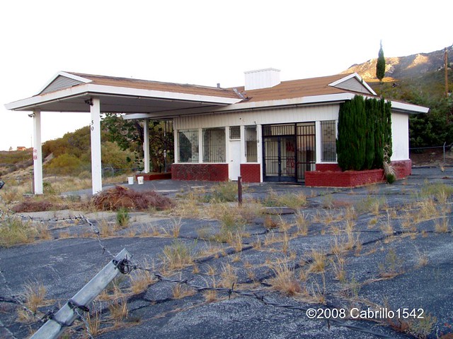
Well that photograph above isn't exactly what people think of when they picture the housing development along Hwy 74 (Palms to Pines Highway) on Santa Rosa Mountain which is more commonly known as Spring Crest. You'll notice of course in the photograph to the right, that the location (which is exactly Spring Crest) was at one time called "Ribbonwood".  Of course that would certainly explain the crossroads sign as located near the old abandoned Gas Station which hasn't been used in decades. 


Oct 2008 - Cabrillo1543
More commonly people are more familiar with the old abandoned Gas Station that hasn't operated in several decades. Take a look below at what most people see when they drive past modern day Spring Crest. Of course several famous folks have had private homes here. Red Skelton had two of them, though I'm not sure if his wife Lothian has them. One was an A-frame house on the top street overlooking this station and another is at the end of the cul-de-sac (deadend street) which is the first street on the right after passing this station. It was always a larger house and sort of a mini ranch home. They never truly lived there, but preferred the modest A-Frame house. Although they purchased that large 660 acre horse ranch in Burnt Valley and I believe this is where Lothian resides now, but I could be wrong. 


Cabrillo1542
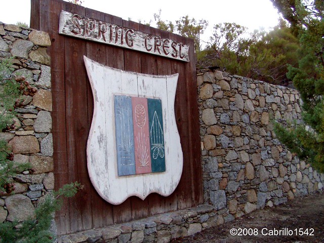
Hwy 74 passes right by Spring Crest and it was here that the above photo locates what was originally called Ribbonwood. Highway 74 is part of that "Palms to Pines Scenic Highway" that was built between 1929 and 1932, finally opening in 1932. As with most of the early highways back then, many entrepreneurs seeking to create business along the highway built little roadside gimmicks to get people to stop and purchase any souvenirs or services before heading on down the road. The roadstop station along the Palms to Pines hwy 73 called Ribbonwood was founded by Wilson Howell. It was a sort of early primitive rest stop for tired travelers who I am sure were ragged after enduring the early rough road conditions back in those days.

Rancho Fruit Market in Temecula


Image from Foursquare
This is probably one of the earliest roadside Fruit stands which much much later became very up until this very day. Hmmm, somewhere at the end of this road with a detour left turn at Paradise Corners to Anza and beyond, there use to be the well known stop called Rancho Fruit Market in the Temecula area right on Hwy 79. It has now moved to old town Temecula after a fire and redevelopment of the land it was once on. But Wilson's place was also another place where one could buy fruits and  vegetables, enjoy a cold drink under an old Ramada (probably made of Redshank) or even rent a Cabin or Kamp spot for the night. Maybe even the weekend. Notice the skyline in the background of Santa Rosa Mountain ?

I found another bit of history that I had read many years back and now it has even been more recently updated. I think readers will find it both sad yet interesting at the same time. In 1959 there was a mystery of sorts surrounding the disappearance of a young woman named Louise Teagarden. She was an outdoors person and friend to even Wilson Howell at the Ribbonwood Camp where she learned much of her outback survival skills. Yet strangely enough on this one occasion, she lived for a couple of months in the wilderness before dying. Her remains were not found until 1991 in a cave in the Palm Canyon Drainage area of which the Spring Crest area (Ribbonwood) on Santa Rosa Mountain is very much a part of the upper headwaters. The Sierra Club actually published an interesting story about Louise Teagarden, who was very experienced as having  outdoors survival skills and yet she mysteriously died. Rather than tell the story over, you may read it for yourself here. 
Sierra Club: "Lost and Found" - Louise Teagarden's Death Still a Mystery
For those a bit more on the impatient side (you really should read it though), there was also a video of the recent 2008 search made for that very cave where she was found. It's only about ten minutes. Writer Ann Japenga, Harry Quinn & Theresa Pawley are making an attempt in the video to locate the actual cave where Lousie Teagarden's remains were found over 30 years later. Very interesting and informative video.


Image - SummitPost.org
Hope everyone enjoyed a bit of forgotten history about this Spring Crest area of the Santa Rosa Mountains. On a very special note, I want everyone to know that when I come back for a visit next year, there is a place almost exactly halfway between that Spring Crest Gas Station and the entrance of Santa Rosa Indian Reservation which has a single sentinel Jeffrey Pine tree right next to the road on the side where travelers would be heading east towards Spring Crest. Not far from the Santa Rosa Truck Trail Forestry road actually. You can find it here on  Google Maps . This of course would be the south side of the Highway 74. Incredibly, on this same Google link, you can click on Satellite tab and zoom in as close as possible at the junction of Hwy 74 & Santa Rosa Truck Trail. proceed west and then just around the bend and down a short grade you'll see this Jeffrey Pine tree over on the left side of the highway. 

After 24 years of traveling this highway back and forth to work, I always passed this single lone beautiful tree and wondered about it. Where did it come from and why is it here of all places miles from any other group of Jeffrey Pines ? This isn't the first time I wondered about how and where certain species of out of place species of trees came from. Hwy 74 west of Mountain Center was another example, which I have previously alluded to in in an earlier post of my discovery of the road construction of Hwy 74 which completely & very deliberately diverted an entire stream (almost a small river) by means of a bulldozer and cutting a path towards the South Fork of the San Jacinto River Canyon. The result is an entire mountainside washed & fell away in a landslide at that canyon with no real possible way of repairing it. And amazingly no one noticed or at least has admitted this. More on this after I actually go out and photograph this area next summer. Incredibly, some extensive Chaparral removal has been conducted around this tree and on up the hillside. Some things never change.


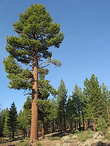
Wikipedia

Example of Jeffrey Pine. Much
larger than the stunted Hwy 74
lone pine tree, but from where
did the original seed come from ?
But what I found around the hills and dry washes around this tree and other canyons north of Hwy 74 in the Palm Canyon drainage were several large (actually huge) Jeffrey Pine stumps and the reason for their continued forensic existence. They still existed because they are completely charred by some historical forest fire which burned who knows when. But traveling back and forth on this road and seeing the rugged chaparral all around, one would never in a million years guess such large pines once existed here. Even as I stood there looking at these as I found them, I was still blown away. I have long suspected that forests were more extensive  and existed further on down the mountain at lower elevations, especially several hundred years back when ancient Lake Cahuilla once exited. Who knows, maybe the climate was more moderate back then. I have wondered and even imagined that more than just the Colorado river contributed to the maintenance of ancient Lake Cahuilla. Wondered whether the White Water River was bigger and greater than it is now. Did Palm Canyon Creek, Tahquitz Creek Canyon and Deep Canyon (Horsethief Creek) water courses also contribute to Lake Cahuilla ? Ultimately I don't now, but I'm still intrigued about the ancient possibilities. 

Tomorrow I'll have Part II which will focus attention on the switched back logging road you can easily view from Sugar Loaf Mountain Cafe. I'll tell you about the man who built that road and the conversation we had on why he was contracted to build it. Much of of the story he told sounded like forestry politics as usual. 

~~~~~~~~~~~~~~~~~~~~~~~~~~~~~~~~~~~~~~~~~~~~
Of Further Reading Interest:
http://www.palmspringslife.com/santarosa/
http://www.annjapenga.com/Images/articles/wHwy74.pdf
http://www.riversidecountyhistory.org/SJM.htm
http://www.santarosacahuilla-nsn.gov/home.htm
http://www.annjapenga.com/Images/articles/wLostandFound.pdf