Showing posts with label fire fighting. Show all posts

Saturday, August 22, 2015

"Day of the Triffids" or "Monolith Monsters" ? (Mexican Fan Palm - Washingtonia robusta)

Korny 1950s Sci-Fi flicks beautifully illustrate some of today's dangerous landscape practices that have gotten out of control
Courtesy of Civano Nursey, Tucson, Arizona

Mexican Fan Palm (Washingtonia robusta)

Well, not exactly "Day of the Triffids" or "Monolith Monsters", but you wouldn't know that by some of the bad public relations they are receiving lately. And yet it is fair to say there are certain maintenance challenges and wildfire dangers that people should be aware of and educate themselves about before installing them in their landscape. A century ago when it came to landscape palms in California, two were the most prominent, the native California Fan Palm (Washingtonia filifera) and the Canary Island Date Palm (Phoenix canariensis). Both have pretty much fallen out of favour with Southern California landscapers and gardeners. Why ? Well, the date palm is messy and when young a major challenge when it comes to space. Also extremely difficult to prune or trim because at the base of the palm frond where it's attached to the tree trunk are some of the most vicious spines you'll ever not want to tackle. The native California Fan Palm is much cleaner maintenance-wise, but it also when mature after some years will also produce date fronds, though much smaller dates. It does have one advantage in that it is much slower growing, but that is also why it was replaced by the Mexican Fan Palm which is much faster growing and provides instant landscape for the Nurseries, landscapers and homeowners who want instant tree. Nobody has patience any patience anymore. Today, it's almost impossible to find a nursery that carries the California Fan Palm and even many native plant nurseries don't carry them or if the do, they are limited and sell out quickly. And while the Mexican Fan Palm has become the typical landscape symbol and taken over the California popularity contest, there are also some major problems with this palm tree.

The Monolith Monsters (1950s monster invasion movie)

image: Desert USA
It was 1957 in a desert town where a geologist found a mysterious rock which grew bigger and propagated itself when it came into contact with water. Towards the end of the movie these monolithic black crystal spires move down this canyon headed for the town. Now where do you suppose these writers got such a crazy idea for such a Sci-Fi script ??? Oh yeah, it's a common sight on the desert side of mountain ranges in SoCal. You can even visit the Palm Springs name sake, Palm Canyon as seen in the photo at right. There are however three negative things to be said about the presence of the Mexican Fan Palm in Southern California's landscape. First it easily escapes the urban landscape and naturalizes into the wilds of Southern California. Second, because of the ease of naturalizing, it has become so invasive that it has smothered many native riparian habitats which effects all the native wildlife. Third, it has become a major component of wildfire spread and loss of homes. This palm tree explodes like a Roman Candle and over a period of 30 minutes while burning can create innumerable sparks or embers which may travel as far as a mile depending on the extreme high wind conditions causing spot fires ahead of the main fire. It and other non-native trees like Salt Cedar or Tamarisk have changed the physical barrier of a riparian habitat which while not fire proof, always could slow a fire down, but it's presence acts as a sort of transportation bridge to newer drier vegetation on the other side of a valley. This naturalizing ability was mentioned a while back in an article in the L.A. Times:
LA Times: "When many of us think of Los Angeles, there’s a palm in the picture. That palm is likely Washingtonia robusta, the Mexican fan palm."
But the region’s palmy past is seeding trouble. “Most of the dates fall nearby,” says licensed herbicide applicator Bill Neill, “but some will eventually go down the storm drains into the river channels.”
And there is another serious problem with this palm so easily invading the infrastructure of Los Angeles, San Diego and other Southern California city's storm drain outlets.
Mexican fans also reduce the flood-control capacity of the L.A. River (and others). Any vegetation will slow water flow, but the U.S. Army Corps of Engineers rips out invasives before it touches native plants. “Willows don’t burn easily,” says Corps ecologist Carvel Bass, “but fan palms and arundo do, and they don’t contribute to the habitat in any positive way.”
While the Mexican Fan Palm does have some wonderful qualities as an ornamental in the landscape, there are those fire safety issues which everyone should understand. They seriously need to have their dried coat of fronds trimmed by professionals. They are dangerous for rookie inexperienced homowners to do this themselves. It's dangerous also for the professionals, this is why so many of them die each year and their business insurance is insanely high. Therefore, watch this video below which is about eleven minutes long and illustrates the tree's ability to create 1000s upon 1000s of burning embers as high as 100 feet in the air and during horrific Santa Ana wind events that are common in Southern California, can blow as far away as a mile and start spot fires, or even house tract in neighbourhoods on fire as was the case with the Witch Creek Fire in 2007 which burned numerous homes in the Rancho Bernardo area of San Diego. On December 25th, 2014, LAFD Engine 68 on scene at Mansfield Avenue & Venice Boulevard in Mid-City encountered a palm tree on fire up against high-tension power lines. Unable to put water directly on the fire due to the high voltage, they requested Department of Water and Power to shut them down. With high winds gusting up to 45 miles per hour fanning the flames, millions of embers flew across Venice Boulevard, threatening cars, businesses and other palm trees down the block. An additional Task Force was called in to handle the flying ember problem that started to collect and pool around the edges of buildings and roof-tops. Firefighters knocked down the burning embers with hand-lines at trash piles across the boulevard and in the alley behind other properties. Eventually Engine 68 set up a stream with its “wagon battery” below the power lines, knocking down most of the fire. 


~~~~~~~~~~~~~~~~~~~~~~~~~~~~~~~~
How Mexican Fan Palm has taken over the city of San Diego, wildlands between housing tracts
I've always wanted to do historical documenting of this tree's spread, mostly because I've never found where anyone else ever has. That is to document the massive invasive takeover within the city limits of San Diego, California by the Mexican Fan Palm, not only in wet riparian stream beds, but also up dry washes and canyons where water traditionally hasn't always present or available. At least before housing and human water wasting changed all of that. Again, thus far I've never seen or heard any authority in San Diego County mention any of this before.

Google Earth: Interstate 8 Freeway just west of College Avenue

Image: Google Earth
These two photo locations above and to the right are the Interstate 8 freeway and College Avenue overpass. The photo above from Google Earth is just west of the College Ave overpass. The photo to the right is on the south side of I-8 and exists to San Diego State University. When I was a small kid in the early 1960s, those palm trees in the creek bed didn't exist. I know because almost few times a month our family often drove back and forth over this route on our way to the beach or to visit a great uncle who lived in Allied Gardens off Navajo Road. However, one day in the middle 60s, I noticed some young palms on the north side of I-8 in the top photo. Also a couple on the south side where the creek bed routed from. Further upstream all the way into the city of La Mesa, they kept getting even bigger. Over the several next decades they all just got bigger and more numerous. Further up the road it was obvious where the source of the seed came from. 


Image: Google Earth

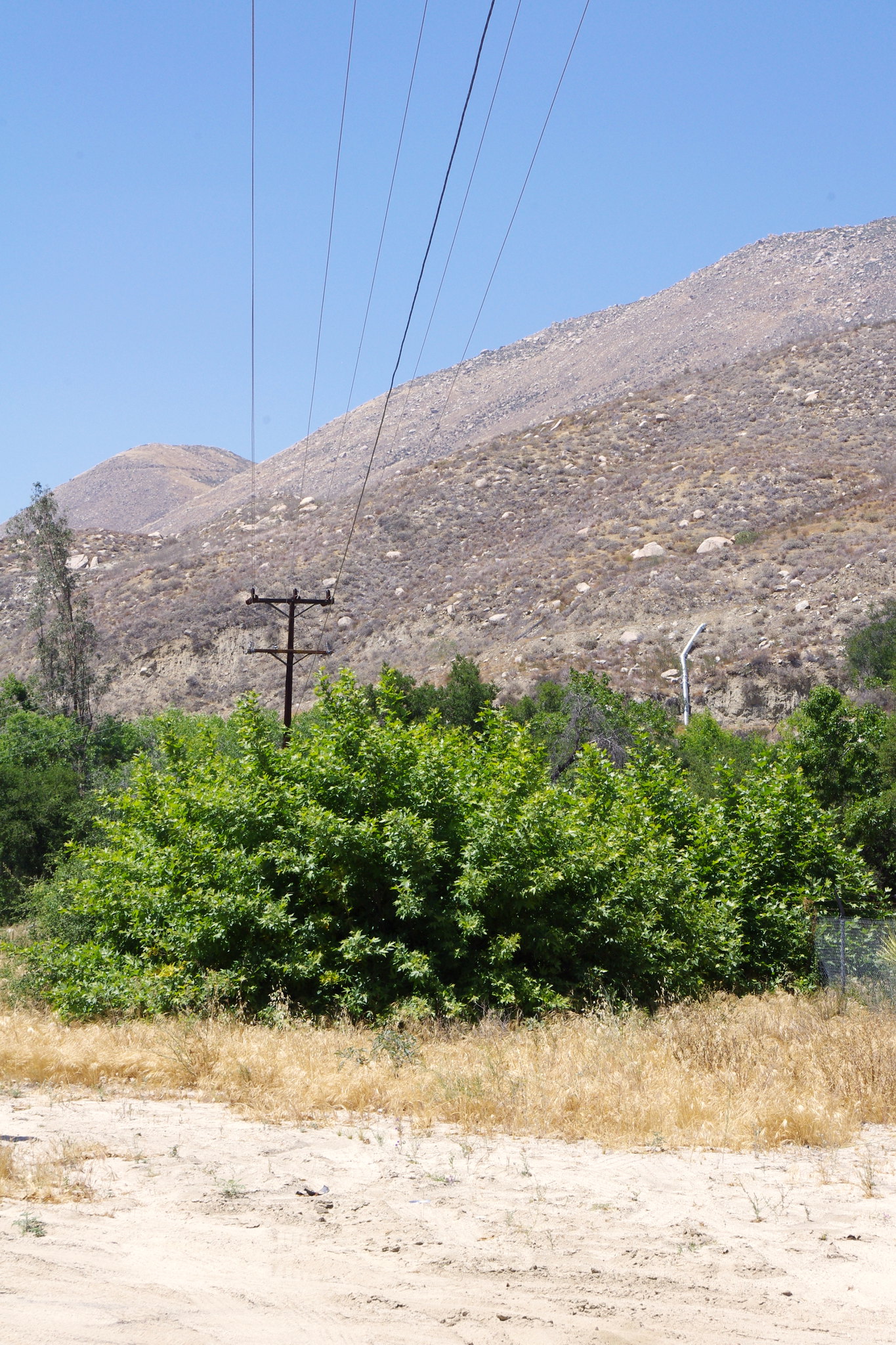
This is the the old former Alvarado Trailer Park on Alvarado Rd in La Mesa which is now called the San Diego RV Resort. Before the change, I seem to recall the old park as going down hill, like so many other older trailer parks in that county which originally started out as roadside Auto Kamps for travelers later converted to permanent residential trailer parks. But back in those early days, almost every single one of them planted a Mexican Fan Palm in each small lot or trailer space. This Resort now has greatly reduced and thinned out considerably the Mexican Fan Palms from what it once was. When I was head landscaper for the property management company in San Diego before moving here to Sweden, one huge mobile home trailer park in El Cajon on Bradley Avenue was also loaded with these palms. The owner of that Mobile Home Park was also a board member of the San Diego Wild Animal Park and years back donated many of them in the early development of the San Diego Wild Animal Park which has since changed it's name to Safari Park. That old Mobile Home Park still has some, but not as it originally did. They are a maintenance nightmare and expense to have professionals come out which is the only was to have it done. But that Trailer Park up on Alvarado Rd in La Mesa was definitely the source of seed for everything down stream. These trees over a life time can produce millions upon millions of seeds. There is something more interesting that most folks living there probably don't know about that first photo next to Interstate 8, although many do, especially the college kids. It's a location below those palms along the freeway which drops off dramatically and is named Adobe Falls.


Here is a link map to the Adobe Falls area along I-8


Adobe Falls Open Space & SDSU Expansion
It's unfortunate that the majority of California College youth who visit here have zero respect for the natural beauty of the area. The irony is that these college types are the so-called Ecology people. Same people who went to Woodstock and Standing Rock Dakota Pipeline protesters labeled themselves as champions of ecology, but their actions spoke louder than their words. Clearly there is no arguing the area has that exotic attraction factor going for visiting it, but after all the drinking and partying they engage in, they leave it a complete mess and have ruined most of the namesake adobe tan bedrock strata loaded up with their graffiti. The photo to the right here is at the top of Adobe Falls just before it takes the plunge down the canyon. I highly doubt that most people are even aware that the palms are all non-native and unnatural to this area. The stream drops sharply and meanders down and around through the valley on it's collision course with the real San Diego River which comes out of Santee, Lakeside and Cuyamaca Mountains to the northeast. But what most don't realize is that every single side canyon on both sides of I-8 is loaded with hundreds of these same large Mexican Fan Palm colonies up and down all the dry washes. Actually the washes are not all that dry any more as they have been utilized by the building industry and city as part of the municipal storm drain infrastructure, Hence the reason for so much extra water which allows palms to thrive. The other reasons for water's permanent presence is basically public wastefulness. Washing cars, watering landscapes, and any number of ways and reasons people use and waste water. Thousands of small curbs and gutters all collectively trickling their cargo together into larger culverts and other flood control channels all meeting upstream and contributing to what was and technically is Alvarado creek. Many references will call this water course north of SDSU as the San Diego River, but Adobe Falls is on Alvarado Creek, not the San Diego River. Alvarado Creek joins the San Diego River at the mouth of that canyon at a district of San Diego called Grantville. They even have a Trolley Station there now. Now let's venture a little further west of Adobe Falls and visit one of the many watershed tributaries along either side of that canyon east of Grantville.

Image: Google Earth

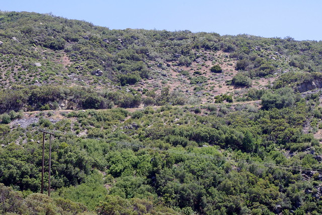
The photograph here is again brought to us from Google Earth. This is about halfway between Waring Road and College Avenue on the south side of Interstate 8 freeway. The bridge you see is fairly new as it is the newer extension of the San Diego Trolley line. So from this east bound shoulder lane looking back up the hillside here of homes just west of SDSU there are a number of tributaries to the main canyons and these were historically almost always dry, except of course now that has all changed with the water run off from public streets above. This is also a north facing slope so evapo-transpiration is going far less than on the south facing slope on the north side of this same canyon which is almost totally lower growing coastal sage scrub. Notice the Mexican Fan Palms. There are actually far more extensive long colonies than the photo here gives credit for. But this is common all the way to the Pacific Ocean on both sides of the greater part of the wide Mission Valley. A simple drive and exploration of canyons and side streets can verify the massive extent to which Mexican Fan Palm has taken over all canyon courses that flow down to Mission Valley. Now lets take a short side trip to the opposite side of Interstate 8 freeway to Waring Road which travels up Navajo Canyon up to Allied Gardens. 

Image: Google Earth

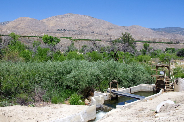
Once again, here's a Google Earth of Waring Road well north of Interstate 8 freeway and just before you drive out of the canyon to the Allied Garden's flat plateau area. The canyon on the left is yet another example of how Mexican Fan Palms have taken advantage of an unnatural circumstances and crowded out the native dry canyon vegetation, but this canyon is no longer dry. It is fed from waste water and storm runoff from the city neighbourhoods above. This has been replicated throughout the entire city and surrounding municipalities. Of course the City's use of the natural geography and dry washes makes sense because these gullies and canyons  efficiently divert flood waters during rainstorm events to keep streets safer and drier. Now I say flood waters because the collectively, all storm water buildup is made by all man the made concrete and asphalt surfaces which eventually come together and causing the flooding. In this Allied Gardens region there are also a number of other plants which have ultimately invaded San Diego's natural riparian corridor of infrastructures and made them a hostile environment to not only native biodiversity, but wildfire hazard to human habitation during these present times of later day mega-wildfires. For example there are three major invaders along with the Mexican Fan Palm, Arundo Cane [Bamboo or sugar cane looking plant], Brazilian Pepper [water loving, unlike the California Pepper which prefers drier circumstances, hence lack of invasive qualities even it will naturalize sporadically] and last but not least the Salt Cedar or Tamarisk [also another major player in not only riparian ruin, but wildfire spread]. The other problem appears to be that in some locations, these fan palms are becoming a storm drain nuisance by hindering flood water movement by impeding it's flow. Here is a photo below where some Fan Palm removal has been taken in Navajo Canyon Open Space.

Image by Eric D. Bier

Navajo Canyon Open Space below Allied Gardens

A slow drive up Waring Road and glancing side to side and you'll just about find them everywhere. Clearly at the top of the plateau where all the 1950s housing tracts are located, people have them in yards everywhere. The Mexican Fan Palm is a heavy producer of seeds and hundreds of seedlings can be found almost anywhere. One of my biggest pet peeves when it comes to plants is the mis-label or mis-identification of trees of the same species and generally [believe it or not] by those who are supposed to be experts. I wrote about this earlier where San Diego Safari Park botanical experts have labeled American Sycamore or London Plane tree as California Sycamore in the Chaparral habitat exhibit. I've seen many Retail Nurseries do the exact same thing. 
So what's the Difference between the two look alike Palms ???
California and Mexican Fan Palm are always incorrectly identified in journals, government reports and science literature. The two couldn't be more different despite some of the obvious similarities in physical appearance. For one the Mexican Fan Palm comes from Mexico, is more slender trucked, eventually getting 70' - 90' or 100' foot tall or more. They are probably the most iconic tall skinny palms seen around Hollywood and other Los Angeles' boulevards, Riverside city streets and orange groves around Redlands, etc. Take a look at the picture to the right. One negative about the fronds and maintenance, unlike the fatter trunk California Fan Palm, the Mexican Fan Palm will shed their fronds in wind storms which creates a dangerous pedestrian or homeowner hazard below. Fire has nothing to to with them falling although they will fall off when on fire and blow far away from the tree creating spot fires well ahead of the main fire front line. The native California holds almost all their fronds throughout life unless they catch fire of course. The leaf frond of the Mexican is also much smaller and brighter green.

The California Fan Palm on the other hand has a much fatter or larger diameter trunk than slender Mexican Fan Palm. The California Fan Palm is also not as high, perhaps to 60 foot. The fronds are a duller olive green and not as bright green as the Mexican Fan Palm. Those fronds are also much much bigger and wider spread than Mexican. The growth of the California Fan Palm is far more slower than the Mexican Fan Palm and this is why they have mostly fallen out of favour with the professional landscaper and their clients who want instant landscape. The reasons you see them in older neighbourhoods of Southern California is because that was the only palm available other than the other icon Canary Island Date Palm, which also naturalizes very well behind the Mexican Fan Palm. There is just no patience anymore for waiting for a tree to actually become a tree. The California Fan Palm also doesn't necessarily naturalize as well as it's Mexican cousin on the western side of the Southern California mountains. not that they can't, but it's not as common. Interestingly, another problem in identification could also come from the fact that both of these Fan Palms will hybridize very easily which I found out in the 1980s-90s was a problem for growers dealing with purebreds in Coachella Valley. 


Call you tell which are California and which is Mexican Fan Palms

Now as a quick example of what I am talking about when it comes to experts who should know better when it comes to plant identification, take a good read of this city of San Diego canyon rehabilitation and maintenance planning report. When you scroll down to page 35, notice the photograph of Rancho Bernardo Canyon and the reference to the trees described as California Fan Palm (Washingtonia filifera) which in reality are clearly Mexican Fan Palms. Not even any mention of the Canary Island Date Palms presence there either. There is simply no excuse for mistakes like this where the city hires expensive experts to do their studies. This is the same irresponsible work that was done by supposed experts  at the San Diego Wild Animal Park's chaparral exhibit. The term California Fan Palm in this instance can be likened to the California Pepper Tree designation. Neither of these trees are natives, but their favoured place in our history of California landscapes is done by humans who as time goes on simply forget the history and consider them as indigenous as they consider themselves. But highly paid experts have no excuses.
http://www.sandiego.gov/planning/programs/mscp/pdf/reports/2013/02_att2b_cyn_sewer_clng_oscac_stat_rpt.pdf
~~~~~~~~~~~~~~~~~~~~~~~~~~~~~~~~~~
It wouldn't be right if I neglected to mention another kool Fan Palm native to Baja California
Mexican Blue Fan Palm (Brahea armata)
Image: Google Earth

Corner of Vulcan St & Danny St , El Cajon California, USA

I know, the yard doesn't look like much, but it use to before it was sold. For four years I walked back and forth from home to work as head landscaper and passed by this house on the corner of Danny St and Vulcan St in El Cajon California. Sometimes I'd just stop in front to gaze at this amazing blue fan palm. What really made the house and yard was this singular giant Mexican Blue Fan Palm standing all by itself in the lawn, much like the ones in the photograph at the right. The palm frond foliage is a beautiful unique blue green with gray haze. Even when it flowers, it's far more beautiful and impressive than the two palms I have described above. This one also had an amazing large diameter trunk as well, the largest I've ever seen. Apparently not long after this house was sold the new owner took a chainsaw to the Blue Fan Palm and removed all but what looked like a perfectly flat round table which they placed potted plants on top for a while. Eventually that stump decayed and they completely removed it as you can see in the above Google photo where the scar is still evident in the lawn. Aside from the shock one day passing by and seeing it being gone, I realized that as a result of the owner's ignorance, he or she lost out on many 1000s of dollars. Such large trees like this one are worth that kind of money because they are so rare to come by and take so long to grow. In that respect they are much like the large Sego Palms in value. The other draw back to these Palms besides people preferring green palms is that this palm is even slower growing than either of the Mexican or California Fan Palm. But apparently this guy didn't know that. One thing I did learn from the growers in Coachella and Thermal is that the Blue Fan Palm when dug out and hauled to a new location has to have it's roots burned to cauterize the wounds because otherwise the palm even if planted will bleed to death. The other fan and date palms you see hauled around on large flat bed trucks and planted do not have this problem. Speaking of hauling palms and planting whole large ready made trees, here is an amazing house transformation below in the Coachella Valley where older 1970s house was remodeled and yard transformed. Beautiful job and I'll close this post with this picture and link of the story underneath the photograph.


Ashley Hacksaw: "A Tour of our House the exterior"
In Defense of the Mexican Fan Palm (Washingtonia robusta)
While it's true I have targeted the Mexican Fan Palm here as the main subject of this article and referenced it's invasive nature as we have labeled it within this Southern California environment, the plant itself is not to blame. It's people. The palm isn't no more invasive than say the Salt Cedar is. The word invasive comes from another word more commonly used with human beings, "invasion". Take a look at the dictionary definition of this word: 
Invasion: "an act or instance of invading or entering as an enemy, especially by an army. the entrance or advent of anything troublesome or harmful, as disease. entrance as if to take possession or overrun"
Today it his becoming popular and hip to assign description of plants as sentient beings. They are not. While scientists utilize many metaphors and euphemisms in describing some of the incredible behavioural traits and complex sensory mechanisms within plants and their cooperation with each other in all  ecosystems, they do so through their genetic programming and sensory epigenetic mechanisms. They simply grow successfully or unsuccessfully within the environment they find themselves placed. When humans in ignorance change their environment it brings consequences. Rather than admitting error on their part, they tend to blame the plants, animals, birds, insects, etc etc etc by assigning to them negative terminology or labels normally used for people, in that they can now justify to their fellow human being why they should be allowed to pursue yet other irresponsible actions [mostly likely of a deadly stupid chemical or mechanical nature] in eliminating them, which often results in further unforeseen consequences. Mexican Fan Palms, like Canary Island Date Palms or Brazilian Pepper Trees are not scheming planning invaders, their sensor mechanisms are simply responding to the changes provided by people who in this case are merely wasting water. Take the water away and the plants will eventually decline in vigor and propagation of themselves will likely also cease. But homeowners and planners should bear in mind the present catastrophic circumstances of Climate Chance they [worldwide] have collectively created and now understand the newer need of  maintaining their landscapes accordingly. I'll have another post on human mistreatment of the natural world is a reflection on how they have treated each other throughout history. Stay tuned!

Update: "Say good-bye to Buena Creek's palm trees"
Image - Gig Conaughton - UT San Diego Staff Writer
"Standing out like sore thumbs in the midst of lush, green willow trees and native plants, every one of the huge palm trees in the environmentally-protected creek are brown from top to bottom, deader than doornails. 
Environmental groups said Friday that the public should not be alarmed. The nonnative palms -- along with towering Eucalyptus trees and fast-spreading Pampas grass -- are being intentionally killed off because they were threatening the creek's native willows, scrub and protected birds and animals."
(Source - San Diego Union Tribune) 
~~~~~~~~~~~~~~~~~~~~~~~~~~~~~~~~
Update: December 15, 2017
NBC San Diego
NBC San Diego: Palm Trees Removed From Rice Canyon in Chula Vista
"A helicopter will be removing more than 80 palm trees from Rice Canyon in Chula Vista Friday.  The Mexican Fan palm trees, which can grow to 60 feet, hinder the growth of native plants, city officials said.  Crews began cutting the invasive trees Monday. Now, the helicopter will pick up the trees one at a time and take them to an area where they can be properly disposed.  Residents of Rancho del Rey Parkway may notice the noise of the helicopter until 4 p.m., officials said.
Further Important Reading References
Southern California and Palm Trees 
Important (September 2015)Update for Landscapers who have chosen Mexican Fan Palm over the California Fan Palm because of it's faster growth for instant tree 
California Fan Palm (Washingtonia filifera) growth explosion with Mycorrhizal Fungi 
~~~~~~~~~~~~~~~~~~~~~~~~~~~~~~~~ 
LA Times: Gardening Hangovers Part-II - Mexican Fan Palms
Piety and Perversity: The Palms of Los Angeles by Victoria Dailey
~~~~~~~~~~~~~~~~~~~~~~~~~~~~~~~~
Examples of Fire Hazards 
Palm trees help spread fire in Yorba Linda

FIREFIGHTERS BATTLING VEGETATION FIRE IN SKY VALLEY

MORNING POLL: HOW MANY WILDFIRES WILL BE CAUSED BY CRAPPY FIREWORKS WITHIN FIRST YEAR OF THEIR LEGALIZATION?

Jesusita Fire likely a sign of things to come Wildfires Drought, invasive weeds, warming put much of state at risk, experts say

Check out the video below of why it is so stupid to allow fireworks any time of year to the public. Trust me, palm trees are prime targets for these creeps
~~~~~~~~~~~~~~~~~~~~~~~~~~~~~~~~
Adobe Falls, San Diego California - SDSU Area
Hidden San Diego: Adobe Falls
 The Daily Aztec: "Trespassers resort to Adobe Falls"
San Diego Reader: "Roam Adobe Creek Falls"
~~~~~~~~~~~~~~~~~~~~~~~~~~~~~~~~
Navajo Canyon Open Space
Navajo Canyon Open Space Trail Map
San Diego Reader: "Navajo Canyon Open Space"

Saturday, August 10, 2013

Common Sense Reasons for Modern Wildfire Intensity

Non-Native Grasses and the human connection for their rapid spread


 photo by Guy McCarthy.
This photo taken around 2:55 p.m. shows smoke rising from
 south of Banning on Aug. 7, 2013. Banning-Beaumont Patch
The scene to the right is Hwy 243 leaving south from downtown Banning up into the San Jacinto Mountains towards Idyllwild California. For almost two decades, I traveled past this very location going to and from work a few times a week. Notice the foothills leading up into the mountains ? They are mostly non-native grasses and other invasive weeds. Not the native wildflowers of the old days when fires went through on a not so regular basis. This week, the Media's favourite so-called Fire expert, Richard Minnich did mention the 1974 Soboba Fire [which gave birth to the Penny Pines Plantation next to Bay Tree Spring - BTW, pines planted were not natives (yet another great Science blunder)] and the (2006 Esperanza fire) which was infamous for taking the lives of five firefighters and burning well over 42,000 acres. He neglected however to mention the 1968 Poppet Flats Fire and the countless other fires which have practically turned this part of the mountain into a mosaic of chaparral and non-native invasive weeds which burn like gasoline (even Minnich admits this). 


image: Mark Alburger

(click on this link to enlarge)
Take a look at the photo above. Some of the first eye witness observer comments were that when the fire first started, it was only 200 acres, but in 30 minutes time it grew to be 2,500. How did that happen ? Grasses! I've watch this mountain range's transformation for almost 25 years now. The lower foothills and steppes are becoming more and more devoid of low sage scrub and the deeper high elevation chaparral is yielding as well. Take the photo above and left here, this same location going across the wash and up the Palms to Pines Hwy 243. Look at the almost pure invasive grass ecosystem which has replaced the majority of the Chaparral. This location has burned almost every years or at length, every couple of years. Not the type of excitement News making fires, but enough to make major impacts on the local ecosystem's demise. In fact, I doubt many remember that on the northern end of Banning of this year 2013, they had a rather large fire back in May called, the "Summit fire". There were some homes lost then as well.
Photo: Stan Lim

CHP Officer Adrian Horta stand at a check point on Hwy 243
looking towards the same exact point of the top photo.
The area is actually one of the worst fires areas for no other reason than that permanently blowing wind through this Pass from the south and west. I seem to remember when every summer in the 1980s to 90s while being in the Hemet/San Jacinto Valley and looking at some dirty gray-brown mushroom cloud to the north and it was always close to this location. From Vista Grande Ranger Station west to Moreno Valley along Hwy 60, these hills have traditionally burned year after year for decades. Grasslands are the predominant ecosystem now which has replaced the low growing chaparral scrub like Buckwheat, California Sagebrush etc. Notice in the third photo here how rapidly that fire has not only grown in size, but even moved west against the westward driven wind flow patterns. The fire speed difference in terms of burn time & distance of a Chaparral landscape versus grass landscape are dramatic. The situation  been made further dangerous by horrible mismanagement created by misguided [though perhaps well intended] Fire Management Policies based & structured solely on the bad science of a select few Forestry-Cult Media figures who are looked upon to as Fire Ecology Gurus. Frankly, their time and outdated thinking should be over. Unfortunately, for many areas, there is no turning back the eco-clock. The results of failed policies based on their bad science reveal that their expertise has destroyed more than they've helped in off fire season management. Scary scenario now is that globally with Climate Shifting, many fire seasons are running close to a full year any more. Something has to change, or the Natural World up in the San Jacinto Mountains and elsewhere will be ruined forever. I use to think Nature could take and handle all manner of abuse, but clearly I was wrong. 

Take the example below of a wildfire management program which is a major failure, although the people behind this Hwy 74 firebreak creation program would probably never admit this. This project I have to imagine was a strategy of creating some imaginary barrier along both sides of Hwy 74 west of Mountain Center and Idyllwild in hopes of preventing a major megafire advance towards those mountain communities. These images expose the incompetent  horrible planning and decision making which demanded the  removal of old growth Chaparral on both sides of the Highway, the result of which has allowed invasive non-native grasses to infiltrate. This terrible decision was started and in progress in 2010 and through 2011 when I last visited this area with my wife. At that time I should have taken photos as it was in progress, but I didn't. However I knew exactly what would happen. There were large massive piles of brush which were later hauled off site to an area for grinding up the chaparral. Now fast forward here to 2013, some chaparral vegetation has grown back, but in a far worse case fire scenario circumstance than previously before chaparral removal. You should know that several psychopath Arsonists have actually tried to start fires here at this east end of the canyon and only created smoldering white smoke previously and were caught as a result of the difficulty of actually getting a raging fire going. The new invasive grass habitat almost guarantees such attempt will succeed in the future.


Photo: Mine
This is the south facing view on a Turnout near the Cold Creek Creek Canyon [which comes out of Mountain Center] at the bottom before highway Route 74 takes a sharp U-Turn and switch backs westward up the mountainside. This was not a Control Burn Project, but rather a chain saw job performed by Hand Crews to remove chaparral to the ground. Then the brush piles were hauled off to disposal sites. The chaparral dander or leaf litter was also removed to bare soil. Stumps were being sprayed with something to further kill them. While the idea may have been well intended  and certainly a form of 'eye-candy' which appeases the Public who demand something be done, the conditions now have been made worse than the previous condition as the photo below reveals.


photo: Mine
These are the dry Foxtail Grasses and European Wild Oats that were never here prior to the cutting of Chaparral. I found them to be all alone the shoulder up through Mountain Center and in the case of the wild oats, I had never before seen up so high. These latest drought conditions are also not allowing the Chaparral to recover quickly. During wetter seasons in decades past, the ecosystem would have repaired itself much more quickly and efficiently. But we are now in an era of changing dry times when it comes to weather issues. The biggest danger here now is that some idiot throws his/her cigarette out the window and ignites another megafire. With the former Chaparral cover scenario, that was never an issue. Even if a fire from a distance comes up the canyon as feared, they have almost guaranteed it's further rapid progress by this horrible decision to defoliate this area of much more stable system and replacing it with a virtual powder keg.

(image from San Jacinto Ranger District off Hwy Route 243)


Here is another photo I took on the way up and in fact there are several. Most of the surrounding San Jacinto Mountain foothills from this S.J. River Canyon to Lambs Canyon (State Route 79) and beyond to Hwy 60 are almost totally solid grasses. What this means is that any future fire under similar conditions will take off far more efficiently speed-wise from a disaster scenario point of view and be so large by the time fire fighters attempt some sort of battle plan organization, that getting an initial upper hand on the situation will be near to impossible. These grasses burn like gasoline, while chaparral, which it can be explosive & spectacular to watch during intense wind extreme moments, quite often burns at a much slower pace which allows for much more efficient timeline fire fighting strategies to be implemented. These next two images are of the southern face of Indian Mountain, though most people won't recognize it, though perhaps only from the northern viewpoint turnout on Hwy 243.


photo image: Mine

This is a view of the southern face of Indian Mountain, though many never think of that landmark from this point of view. A number of Truck Trails like Indian Creek, North Fork of S.J. River and Bee Canyon Truck Trail are present on this side of the mountain. This side of the mountain has burned numerous times in the past and as you can see it being presently dominated by non-native European exotic grasses. When the Bee Canyon Fire blew over this area, there was still some low growing Chaparral scrub, and it made fast progress. However, it is almost entirely grasses, and an even faster fire growth scenario will most surely take place next time and there WILL be a NEXT TIME. When I originally moved to the San Jacinto Mountains back in 1981, this same mountain was dominated by an interior version of coastal sage scrub plant community. A photo then would be showing a darker green plant presence across the same non-native grassland at present. 


photo: Mine

(click to enlarge view)
This view of the irrigation aqueduct which funnels water from Lake Hemet via the South Fork of the San Jacinto River is directly across from Cranston Ranger Station. Same pic as above but from different perspective. Below is a link further up the road at the S.J. North Fork crossing. Click to enlarge and zoom up that mountain in the background and take in the unnatural grasslandscape.


photo Mine(click here to enlarge the view)
I took this photo this past May 2013. It is a view of the grass infested southern foothill terrain of the northern part of the San Jacinto Valley. These hills have been burned off countless multiple times and are a rapid fire tinder box just waiting to explode again. Movement of fire of course would be in the same direction as the present Silver Fire. Soboba Indian Reservation was always notorious for starting many of these devastating fires. There was hardly a summer which went by in the 80s and 90s where smoke couldn't be seen in the mountain terrain above that Casino.
The main issue here is that the Chaparral Plant Community is almost always unfairly and UNSCIENTIFICALLY blamed for the destruction of human infrastructure over the past few decades. But as you can clearly see, there have been many homes which burned with intact trees, chaparral and exotic landscape often left untouched by flames and homes burned to the ground. Why ? Some homes in this latest Silver Fire have been burned to the ground with large bare ground defensive clearances and yet they burned down to the ground, Why ? Most of it has to your with regular maintenance. Your home and garden/Landscape need proper regular personal hygiene just like your own body. Neglect this and problems develop. Most rain gutter and roof tiles need cleaning or when embers rain down like a downpour of a Thunderstorm, these things get blown into the cracks and crevices where they smolder and eventually ignite. The flame is at first very tiny and almost un-noticeable. But gradually it can be doing some internal burning within the structure's walls.  
One morning early in 1993, I remember waking up early and listening to the News Reports going crazy about numerous major wildfires going on in Southern California all at once. It was October and the Santa Ana winds were in full force. The Laguna Hills and Beach fires seemed to have gotten most of the attention, but there were others closer to hone which were of more concern to me. The October 1993 Winchester Fire which burned 25,000 acres in almost a day, was a burn which mostly blitzed at lightning speed  through nothing more than a grassland plant community. Grass is like Petrol when it burns. There were 29 homes lost on those grassland flats where the fire burned from south end of State Street Hemet near the present Diamond Valley Reservoir Headquarters  [which had not yet existed] all the way to Lake Skinner and French Valley near Temecula. So 29 Homes in grassland were destroyed and if there was any chaparral at all in these valleys and rolling hills, it was low growing coastal sage scrub plant community being overwhelmed by grasses. To be honest, much of this area was also the former Kaiser Cattle Ranch from which most of Temecula is now built on top of. Cattle Ranchers want grasses, not what they term as invasive brush [vulgar term for chaparral] which impedes their business model. Mostly this Winchester Fire in 1993 was one massive grassland. Most of the non-native grasses, brought here by error-prone humans ignorant of their effects on the native local landscape were the real culprit, not chaparral. And yet the grasses cannot be totally blamed either, as human ignorance in land management over many decades has facilitated their wider spread. There is something else I also remember about this day. During this same Winchester Burn in 1993, something else was also happening right up in Anza in and around the Cahuilla Creek Casino and Lake Riverside Estates. After being glued to the Television News Updates, I decided to take a walk outside and see if I could see any of the smoke from the Winchester fire that was given occasional mention. The Santa Ana Wind conditions were blowing fierce at my hilltop home and there was another fire for which the News had yet to mention. A Fire started up in Anza with it's flash point of origin as an Electrical Pole near the Cahuilla Indian Reservation Cemetery. Incredibly, at the beginning, this fire burned through a wide swath of the green Sedge  meadow landscape at lightning speed burning all the way to Lake Riverside and Cowboy Country Trailer Park on Bradford Road. This was reminiscent of what was said about a green grassy meadow in the Mount Jacinto high country just a few weeks ago which they said went up in a flash. Under normal healthy conditions, Sedges generally are not a flash point, but conditions in our times have changed. These non-native exotic grasses taking over once native chaparral landscapes will continue to spark the megafires making far worse and more uncontrollable than ever before. Climate Shift will only exacerbate the problem, but will anyone really be paying any attention by NOT blaming Chaparral ? Will they now stop listening to many of those supposedly qualified Fire Ecology experts who know nothing of how the chaparral plant community actually functions and put a halt to their failed Control Burn operations in remote wilderness areas far away from any urban areas which has thrown nature off balance ? Not only that, it wastes resources and eats up money which could otherwise be used for actually fighting the fires which are going to happen whether they do anything or not. Of course, the average citizen should not depend on the authorities to actually save anything, but there are some thing that you can do as far as home construction details. While different circumstances, solutions and money will dictate what you are able to do, there are still some interesting details mentioned in the link under the photo below.
(AP Photo/Douglas C. Pizac) 

 Fire-Resistant Details

"The October 1993 Laguna Hills Fire  destroyed more than 350 homes  in a single day (more here). In this image: a single home sits virtually  untouched in Laguna Beach, California, on October 28, 1993, after wildfires reduced neighboring homes, and hundreds of others,  to rubble. When the Bui/Bender residence (pictured above) survived  the devastating 1993 fire in the Southern California Coastal town  of Laguna Beach, people called it a miracle. The fact that the only damage to the structure was a drainage downspout dislodged by a fire hose may have had more to do with the fact that it was designed and constructed in accordance with the principles outlined  in this very interesting article from Fine Home Building."
~~~~~~~~~~~~~~~~~~~~~~~~~~~~~~~~
Some relevant links on the October 26/27 1993 Winchester Fire & 17 others: 
Endangered Species Act and Fire Controversy that followed the 1993 Winchester Fire
The Wildfires of Southern California in 1993
What more is there to say, but people need to pay attention to the way fire dynamics are changing for the worse and plan accordingly. The bad land management examples being practiced by irresponsible agencies should be improved upon by the average land owner IF they actually care about their own property. Previously I touched on this here:
Forestry's Land Mismanagement has an Influencing Effect on it's Citizens
~~~~~~~~~~~~~~~~~~~~~~~~~~~~~~~~
Further Research References: 
The California Chaparral Institute
"The Banning Silver Fire Photos - Illustrations that Teach"
Wildfire Potential for Southern California August thru November 2013